MyTopo
Stony Creek Virginia US Topo Map
Couldn't load pickup availability
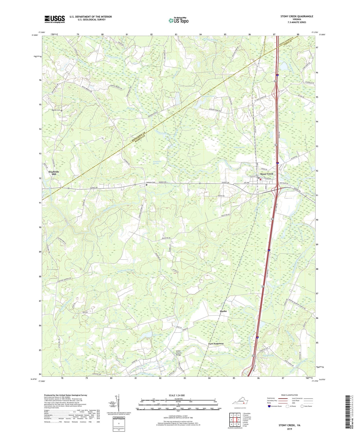
2022 topographic map quadrangle Stony Creek in the state of Virginia. Scale: 1:24000. Based on the newly updated USGS 7.5' US Topo map series, this map is in the following counties: Sussex, Dinwiddie, Prince George. The map contains contour data, water features, and other items you are used to seeing on USGS maps, but also has updated roads and other features. This is the next generation of topographic maps. Printed on high-quality waterproof paper with UV fade-resistant inks.
Quads adjacent to this one:
West: Cherry Hill
Northwest: Dinwiddie
North: Carson
Northeast: Templeton
East: Sussex
Southeast: Yale
South: Jarratt
Southwest: Purdy
This map covers the same area as the classic USGS quad with code o36077h4.
Contains the following named places: Black Branch, Bolling Swamp, Flat Swamp, Fort Nottoway, Galley Swamp, Green Church Bridge, Halifax School, High Hill Branch, Huske, Huske School, Island Swamp, Jones School, Lewis Dam, Lewis Pond, Little Bethel Church, Little Bethel School, Morgans Dam, Morgans Pond, Mortar Branch, Peaquarter Swamp, Pegram Cemetery, Rack Creek, Rocky Branch, Saint Johns Church, Saint Johns School, Sappony Cemetery, Sappony Church, Sappony Creek, Snake Branch, Southwest Swamp, Spiers Dam, Spiers Pond, Stony Creek, Stony Creek District, Stony Creek High School, Stony Creek Post Office, Stony Creek Rescue Squad, Stony Creek Volunteer Fire Department, Town of Stony Creek, Winfields Mill, Winfields Millpond, ZIP Code: 23882