MyTopo
Castle Craig Virginia US Topo Map
Couldn't load pickup availability
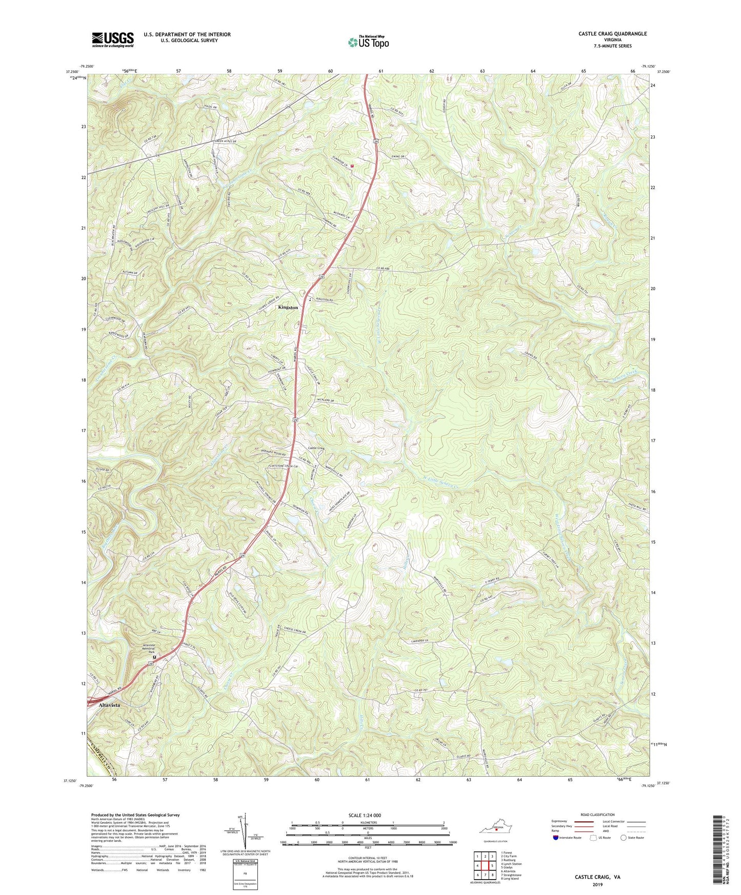
2022 topographic map quadrangle Castle Craig in the state of Virginia. Scale: 1:24000. Based on the newly updated USGS 7.5' US Topo map series, this map is in the following counties: Campbell, Pittsylvania. The map contains contour data, water features, and other items you are used to seeing on USGS maps, but also has updated roads and other features. This is the next generation of topographic maps. Printed on high-quality waterproof paper with UV fade-resistant inks.
Quads adjacent to this one:
West: Lynch Station
Northwest: Forest
North: City Farm
Northeast: Rustburg
East: Gladys
Southeast: Long Island
South: Straightstone
Southwest: Altavista
This map covers the same area as the classic USGS quad with code o37079b2.
Contains the following named places: Altavista Memorial Park, Calvary Church, Castle Craig, Chapel Grove Church, Christ Church, Evington Volunteer Fire Department Substation, Flintstone Creek, Grace Church, Kingston, Lambs Church, Liberty Church, Mount Pleasant Church, New Hope Church, Penuel Church, Rough Creek, Salem Church, Seminole Lake, Seneca District, West Little Seneca Creek, WKDE-FM (Altavista), ZIP Codes: 24517, 24550