MyTopo
Fort Mitchell Virginia US Topo Map
Couldn't load pickup availability
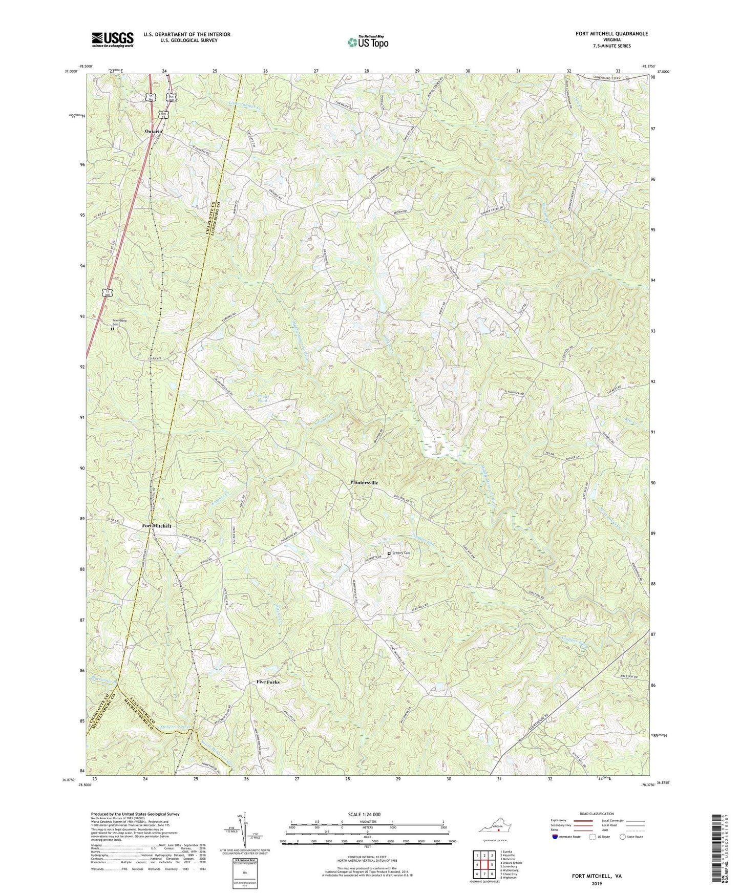
2022 topographic map quadrangle Fort Mitchell in the state of Virginia. Scale: 1:24000. Based on the newly updated USGS 7.5' US Topo map series, this map is in the following counties: Lunenburg, Charlotte, Mecklenburg. The map contains contour data, water features, and other items you are used to seeing on USGS maps, but also has updated roads and other features. This is the next generation of topographic maps. Printed on high-quality waterproof paper with UV fade-resistant inks.
Quads adjacent to this one:
West: Drakes Branch
Northwest: Eureka
North: Keysville
Northeast: Meherrin
East: Lunenburg
Southeast: Wightman
South: Chase City
Southwest: Wylliesburg
This map covers the same area as the classic USGS quad with code o36078h4.
Contains the following named places: Blackwater Branch, Blevins Corner, Cool Spring Church, Crupper Run, Finneywood, Five Forks, Fort Mitchell, Friendship Baptist Church, Friendship Cemetery, Gregory Cemetery, Kells Corner, Kirk Dam, Knights Creek, Kunath Store, Little Juniper Creek, Mount Mitchell Church, Mount Zion Church, Old Church, Ontario, Plantersville, Rehoboth District, Robertson Store, Salem Church, Stokes Creek, Wallaces Store, West End School