MyTopo
Check Virginia US Topo Map
Couldn't load pickup availability
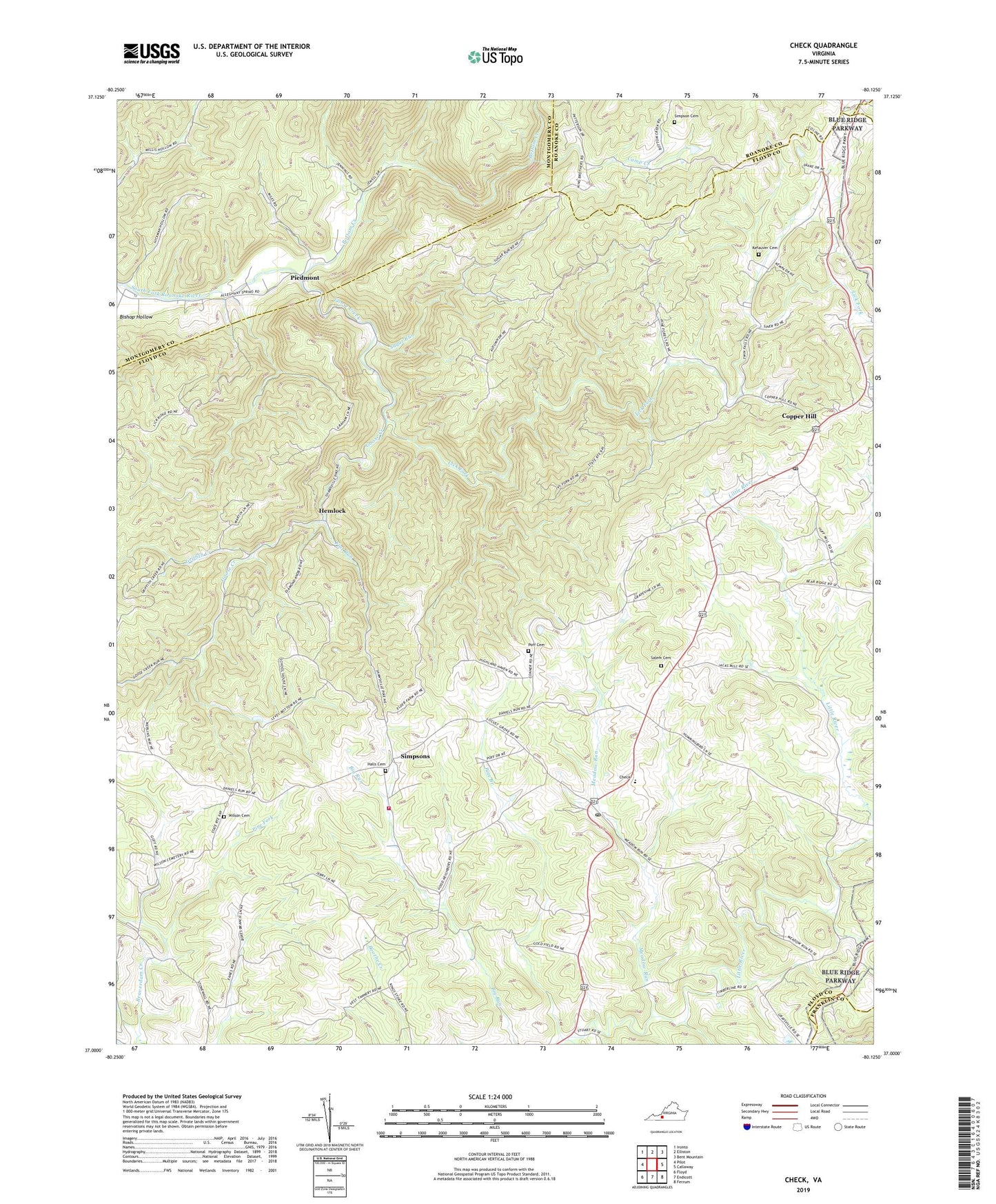
2019 topographic map quadrangle Check in the state of Virginia. Scale: 1:24000. Based on the newly updated USGS 7.5' US Topo map series, this map is in the following counties: Floyd, Montgomery, Roanoke, Franklin. The map contains contour data, water features, and other items you are used to seeing on USGS maps, but also has updated roads and other features. This is the next generation of topographic maps. Printed on high-quality waterproof paper with UV fade-resistant inks.
Quads adjacent to this one:
West: Pilot
Northwest: Ironto
North: Elliston
Northeast: Bent Mountain
East: Callaway
Southeast: Ferrum
South: Endicott
Southwest: Floyd
Contains the following named places: Bottom Creek, Camp Creek, Camp Kiwanianna, Check, Check Elementary School, Check Post Office, Christo Church, Copper Hill, Copper Hill Church of the Brethren, Copper Hill Post Office, Crossroads Union Chapel, Flat Run, Floyd County Emergency Medical Services Station 3, Floyd County Volunteer Fire Department 3, Goose Creek, Griffith Creek, Halls Cemetery, Head of the River Church, Hemlock, Hemlock Church, Kefauver Cemetery, Lick Fork, Locust Grove District, Meadow Run, Mount Olivet Church, Piedmont, Piedmont Camp Meeting Grounds Historic District, Pine Branch, Pine Forest Church, Pine Fork, Poff Cemetery, Saint Pauls Church, Salem Cemetery, Simpson Cemetery, Simpsons, Simpsons Mission, Smiths Chapel, Sugar Run, Tices Mill, Willis Store, Wilson Cemetery, ZIP Codes: 24072, 24079