MyTopo
Endicott Virginia US Topo Map
Couldn't load pickup availability
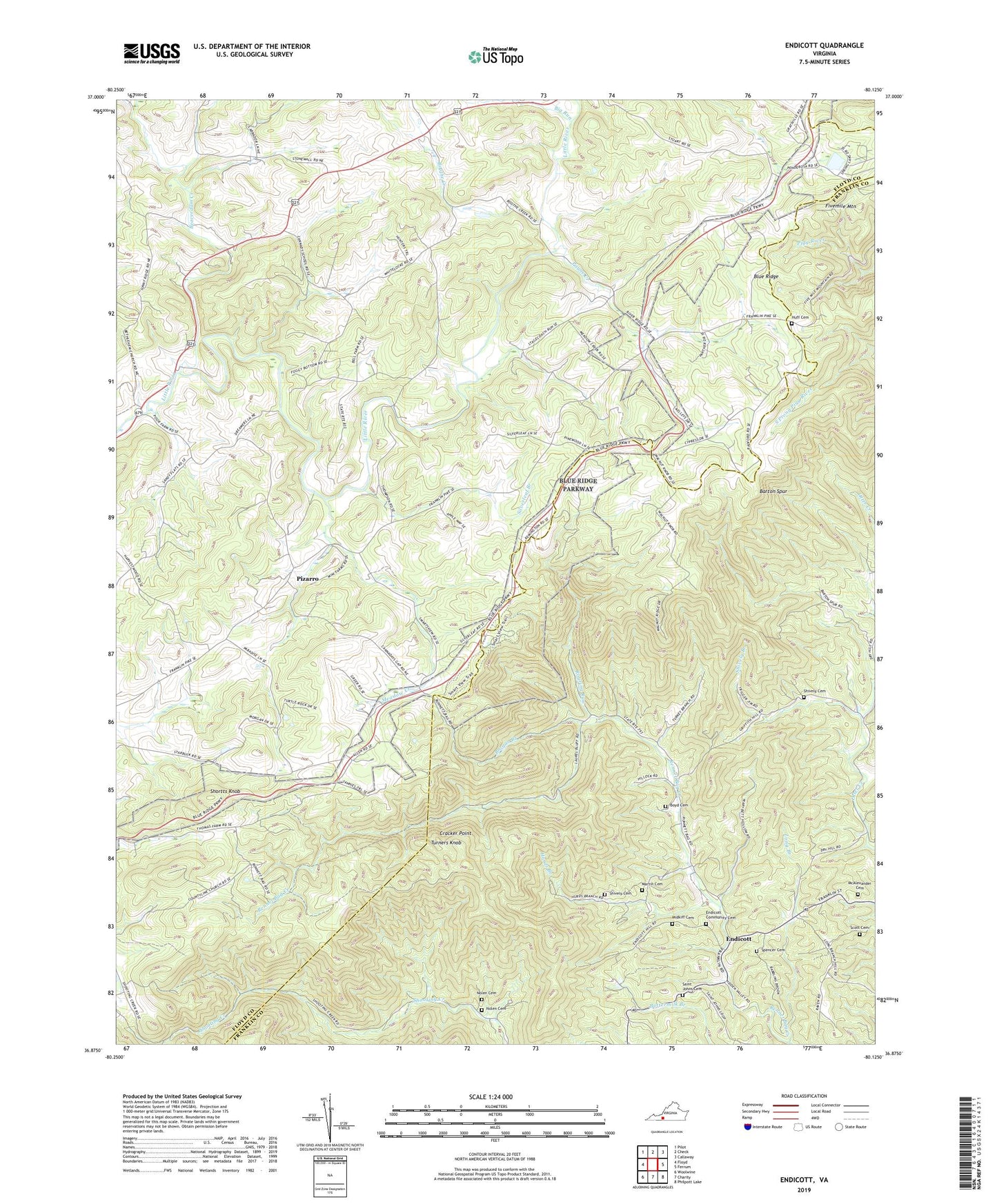
2022 topographic map quadrangle Endicott in the state of Virginia. Scale: 1:24000. Based on the newly updated USGS 7.5' US Topo map series, this map is in the following counties: Floyd, Franklin. The map contains contour data, water features, and other items you are used to seeing on USGS maps, but also has updated roads and other features. This is the next generation of topographic maps. Printed on high-quality waterproof paper with UV fade-resistant inks.
Quads adjacent to this one:
West: Floyd
Northwest: Pilot
North: Check
Northeast: Callaway
East: Ferrum
Southeast: Philpott Lake
South: Charity
Southwest: Woolwine
This map covers the same area as the classic USGS quad with code o36080h2.
Contains the following named places: Barton Spur, Beaverdam Creek, Big Run, Boothe Creek, Boyd Cemetery, Brogan Branch, Burdettes Dam, Burdettes Pond, Cannaday Church, Cannaday Gap, County Line Church, Cracker Point, Endicott, Endicott Church, Endicott Community Cemetery, Fivemile Mountain, Floyd County Farm, Harvestwood Church, House of Prayer, Huff Cemetery, Hurds Branch, Kings Store, Long Branch, Long Branch Church, Martin Cemetery, McAlexander Cemetery, Meadow Creek, Midkiff Cemetery, Nolen Cemetery, Park Ridge Dam, Payne Creek, Payne Creek Church, Pizarro, Roaring Run, Saint Johns Cemetery, Saint Johns Church, Saint Johns School, Scott Cemetery, Shively Branch, Shively Cemetery, Shortts Knob, Silverleaf Branch, Silverleaf Church, Smart, Smart View Overlook, Smart View Recreation Area, Spencer Cemetery, Stonewall Church, Trinity Church, Turners Knob, Woods Store