MyTopo
Floyd Virginia US Topo Map
Couldn't load pickup availability
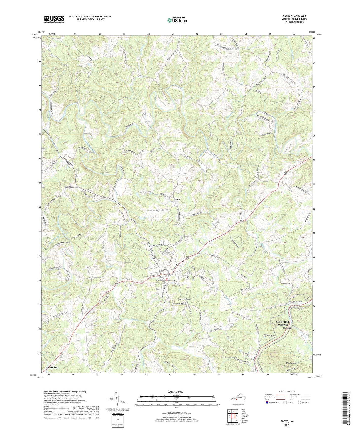
2022 topographic map quadrangle Floyd in the state of Virginia. Scale: 1:24000. Based on the newly updated USGS 7.5' US Topo map series, this map is in the following counties: Floyd. The map contains contour data, water features, and other items you are used to seeing on USGS maps, but also has updated roads and other features. This is the next generation of topographic maps. Printed on high-quality waterproof paper with UV fade-resistant inks.
Quads adjacent to this one:
West: Alum Ridge
Northwest: Riner
North: Pilot
Northeast: Check
East: Endicott
Southeast: Charity
South: Woolwine
Southwest: Willis
This map covers the same area as the classic USGS quad with code o36080h3.
Contains the following named places: Beaver Creek, Beaver Creek Church, Blue Mountain School, Camp Bethel United Methodist Church, Camp Creek, Conner Dairy Farms, Court House District, Dodd Creek, Falling Branch Church, Floyd, Floyd Baptist Church, Floyd Church of the Nazarene, Floyd County, Floyd County Courthouse, Floyd County High School, Floyd County Life Saving and First Aid Squad Station 1, Floyd County Sheriff's Office, Floyd County Volunteer Fire Department 1, Floyd Elementary School, Floyd Post Office, Floyd Speedway, Floyd Town Hall, Floyd United Methodist Church, Great Oaks Country Club, Huckleberry Creek, Jacksonville Academy, Jacksonville Cemetery, Jessie Peterman Memorial Library, Little River District, Middle Creek, New Haven Church, Oldfield Creek, Pine Creek, Pine Creek Church, Poff, Red Oak Grove Church, Scott Dam, Shelors Mill, Shooting Creek Quarry, Simmons Creek, Stockers Knob, Terrys Creek, The Haycocks, The Presbyterian Church of Floyd, Town of Floyd, West Fork Dodd Creek, West Fork Little River, WGFC-AM (Floyd), Zion Church, ZIP Code: 24091