MyTopo
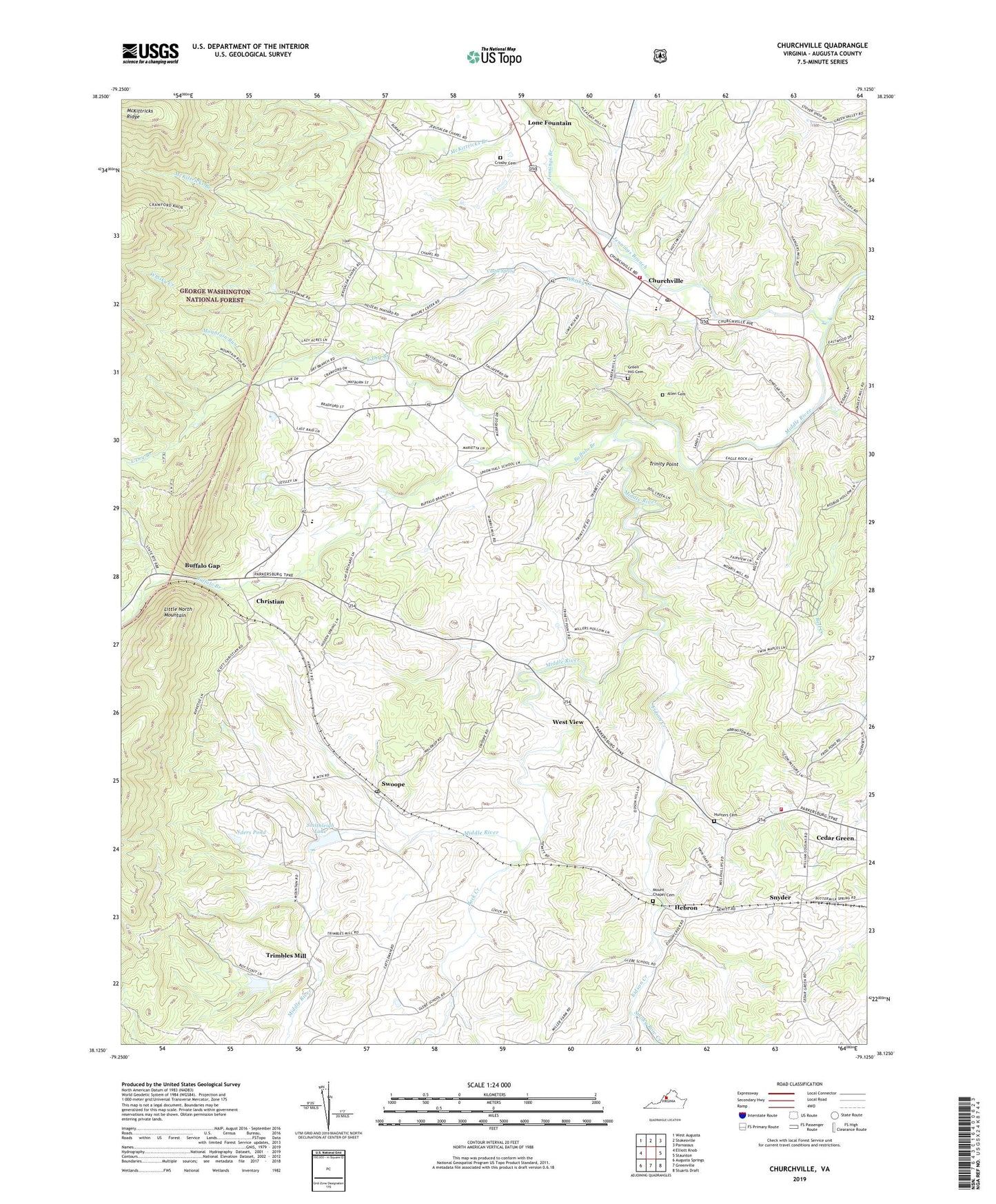
Churchville Virginia US Topo Map
Couldn't load pickup availability
2019 topographic map quadrangle Churchville in the state of Virginia. Scale: 1:24000. Based on the newly updated USGS 7.5' US Topo map series, this map is in the following counties: Augusta. The map contains contour data, water features, and other items you are used to seeing on USGS maps, but also has updated roads and other features. This is the next generation of topographic maps. Printed on high-quality waterproof paper with UV fade-resistant inks.
Quads adjacent to this one:
West: Elliott Knob
Northwest: West Augusta
North: Stokesville
Northeast: Parnassus
East: Staunton
Southeast: Stuarts Draft
South: Greenville
Southwest: Augusta Springs
Contains the following named places: Allen Cemetery, Augusta County, Augusta County Training School, Back Creek, Bethlehem Church, Boy Scout Lake, Buffalo Branch, Buffalo Gap, Buffalo Gap High School, Camp Shenandoah, Camp Shenandoah Dam, Castle Spring, Cedar Green, Christian, Churchville, Churchville Census Designated Place, Churchville Elementary School, Churchville Post Office, Churchville Volunteer Fire Rescue Department Company 4 Rescue 4, Crosby Cemetery, East Dry Branch, Eidson Creek, Green Hill Cemetery, Hebron, Hebron Church, Hunter Cemetery, Jennings Branch, Jerusalem Church, La Grange, Lock Willow Presbyterian Church, Lone Fountain, McKittricks Branch, Mount Chapel Cemetery, Mount View Church, Mount Zion Church, Mountain Run, Nders Pond, North Fork McKittricks Branch, Saint Pauls Chapel, Smithleigh Dam, Smithleigh Lake, Smoky Row Church, Smoky Row Creek, Snyder, Swoope, Swoope Post Office, Swoope Volunteer Fire Department Company 14, Trimbles Mill, Trinity Point, West View, Whisky Creek, WNLR-AM (Churchville), Wood Dam, WSKO-FM (Buffalo Gap), ZIP Codes: 24421, 24479