MyTopo
Columbia Virginia US Topo Map
Couldn't load pickup availability
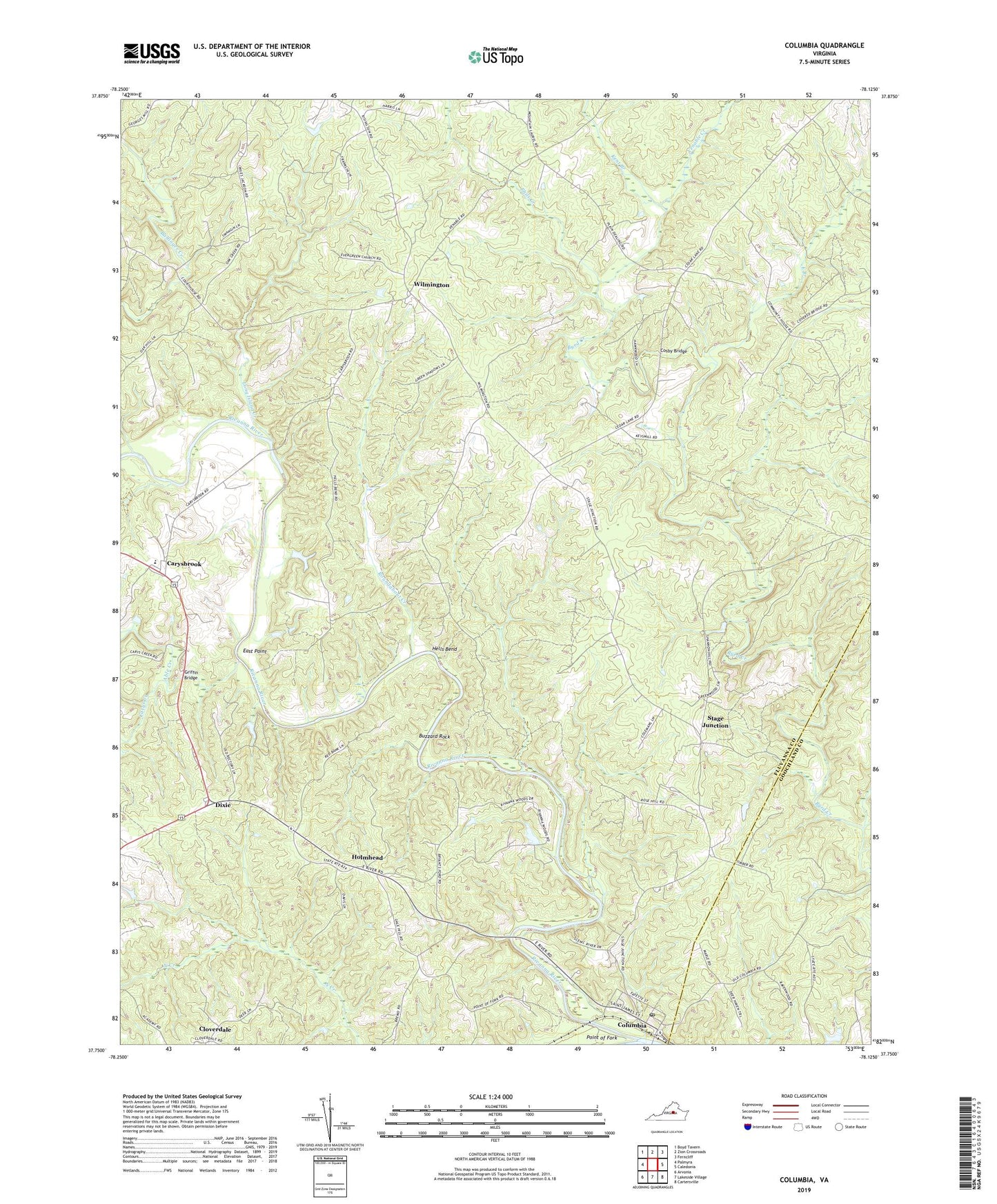
2022 topographic map quadrangle Columbia in the state of Virginia. Scale: 1:24000. Based on the newly updated USGS 7.5' US Topo map series, this map is in the following counties: Fluvanna, Goochland. The map contains contour data, water features, and other items you are used to seeing on USGS maps, but also has updated roads and other features. This is the next generation of topographic maps. Printed on high-quality waterproof paper with UV fade-resistant inks.
Quads adjacent to this one:
West: Palmyra
Northwest: Boyd Tavern
North: Zion Crossroads
Northeast: Ferncliff
East: Caledonia
Southeast: Cartersville
South: Lakeside Village
Southwest: Arvonia
This map covers the same area as the classic USGS quad with code o37078g2.
Contains the following named places: Able Creek, Buzzard Rock, Byrd Grove Church, Carys Creek, Carys Creek Wayside, Carysbrook, Cloverdale, Columbia, Columbia Census Designated Place, Columbia Elementary School, Columbia Post Office, Cosby Bridge, Dixie, East Branch, East Point, Evergreen Church, Goshen Church, Gravel Hill Church, Griffin Bridge, Hells Bend, Hollywood School, Holmhead, Holy Church, James River Farms, Johnson Store, Kent Branch, Long Island Creek, Lyle Church, Phils Creek, Point of Fork, Rasawek, Rivanna Mills, Rivanna River, Roundabout Creek, Shepherds Store, Stage Junction, Town of Columbia, Venable Creek, Williams Creek, Wilmington, ZIP Codes: 23038, 23055