MyTopo
Zion Crossroads Virginia US Topo Map
Couldn't load pickup availability
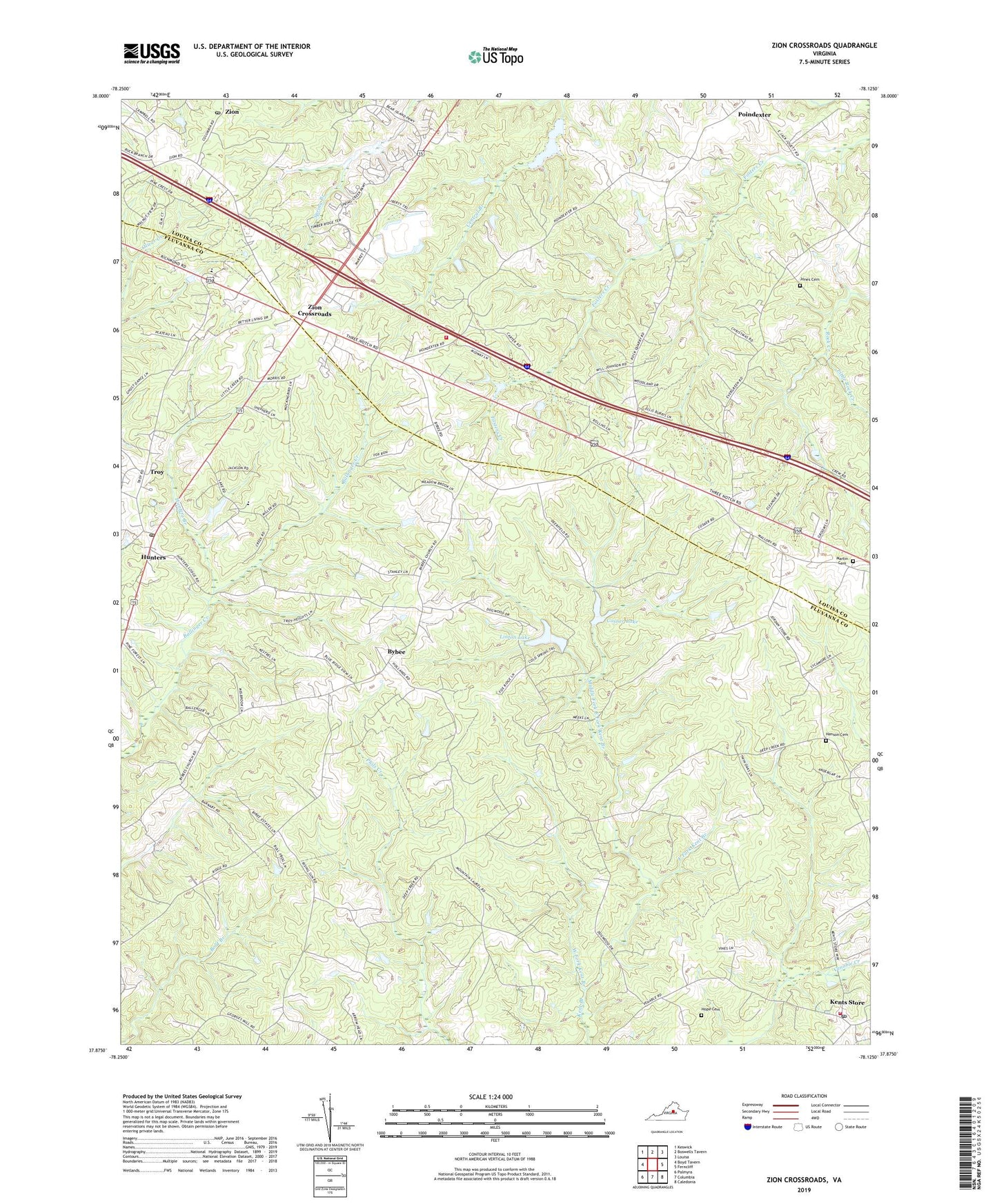
2022 topographic map quadrangle Zion Crossroads in the state of Virginia. Scale: 1:24000. Based on the newly updated USGS 7.5' US Topo map series, this map is in the following counties: Fluvanna, Louisa. The map contains contour data, water features, and other items you are used to seeing on USGS maps, but also has updated roads and other features. This is the next generation of topographic maps. Printed on high-quality waterproof paper with UV fade-resistant inks.
Quads adjacent to this one:
West: Boyd Tavern
Northwest: Keswick
North: Boswells Tavern
Northeast: Louisa
East: Ferncliff
Southeast: Caledonia
South: Columbia
Southwest: Palmyra
This map covers the same area as the classic USGS quad with code o37078h2.
Contains the following named places: Bybee, Bybee Road Church, Center Hill Community Center, Columbia District, Cosner Dam, Cosner Lake, Cranks, East Fork Kent Branch, Evergreen Church, Ferncliff School, Fosters Creek Church, Henson Cemetery, Hensons Store, Hope Cemetery, Hunters, Hunters Branch, Jones Cemetery, Jordans Store, Kents Store, Kents Store Post Office, Kents Store Rescue Squad, Kents Store Rescue Station, Kents Store Volunteer Fire Company, Linton Dam, Linton Lake, Little Rock Creek, Mallory, Mallory Post Office, Martin Cemetery, Middle Fork East Fork Kent Branch, Open Door Christian School, Springfield Church, Trice, Troy, Troy Post Office, West Fork Kent Branch, Yanceys Store, Zion, Zion Church, Zion Crossroads, Zion Crossroads Volunteer Fire / Rescue Department, Zion Crossroads Volunteer Fire Department Company 7, Zion Post Office