MyTopo
Craigsville Virginia US Topo Map
Couldn't load pickup availability
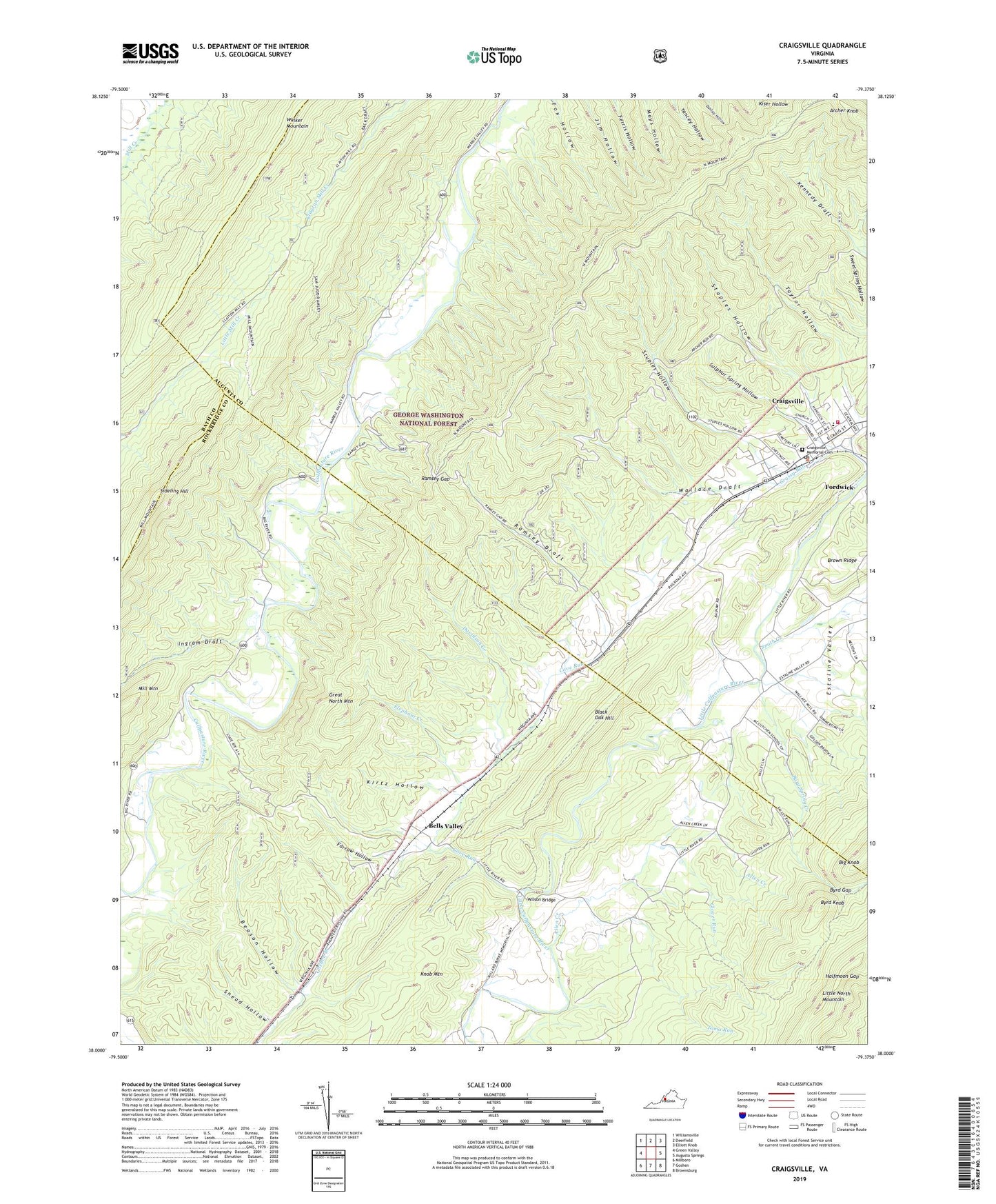
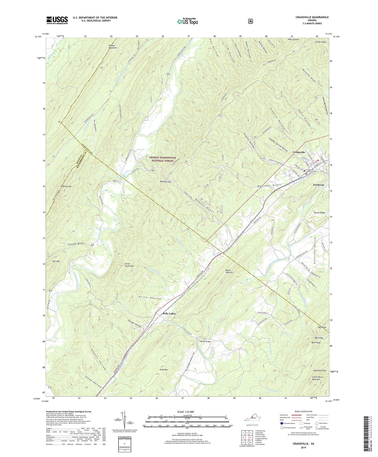
2019 topographic map quadrangle Craigsville in the state of Virginia. Scale: 1:24000. Based on the newly updated USGS 7.5' US Topo map series, this map is in the following counties: Augusta, Rockbridge, Bath. The map contains contour data, water features, and other items you are used to seeing on USGS maps, but also has updated roads and other features. This is the next generation of topographic maps. Printed on high-quality waterproof paper with UV fade-resistant inks.
Quads adjacent to this one:
West: Green Valley
Northwest: Williamsville
North: Deerfield
Northeast: Elliott Knob
East: Augusta Springs
Southeast: Brownsburg
South: Goshen
Southwest: Millboro
Contains the following named places: Allen Creek, Archer Knob, Beason Hollow, Bells Valley, Black Oak Hill, Byrd Gap, Byrd Knob, Byrd Spring Creek, Casta Line Trout Farms, Cove Run, Craigsville, Craigsville - Augusta Springs First Aid Crew Rescue 16, Craigsville Elementary School, Craigsville Memorial Cemetery, Craigsville Post Office, Craigsville Volunteer Fire Department Company 8, Davidson Creek, Elephant Creek, Estaline Valley, Farrow Hollow, Glover Run, Grassy Run, Halfmoon Gap, Holmes School, Ingram Draft, Kirtz Hollow, Lebanon Church, Little River Church, North Mountain Trail, Ramsey Draft, Ramsey Gap, Sideling Hill, Smith Creek, Snead Hollow, Staples Hollow, Stuples Hollow, Sulphur Spring Hollow, Taylor Hollow, Toma Run, Town of Craigsville, Walker Mountain Trail, Wallace Draft, Wilson Bridge