MyTopo
Cumberland Virginia US Topo Map
Couldn't load pickup availability
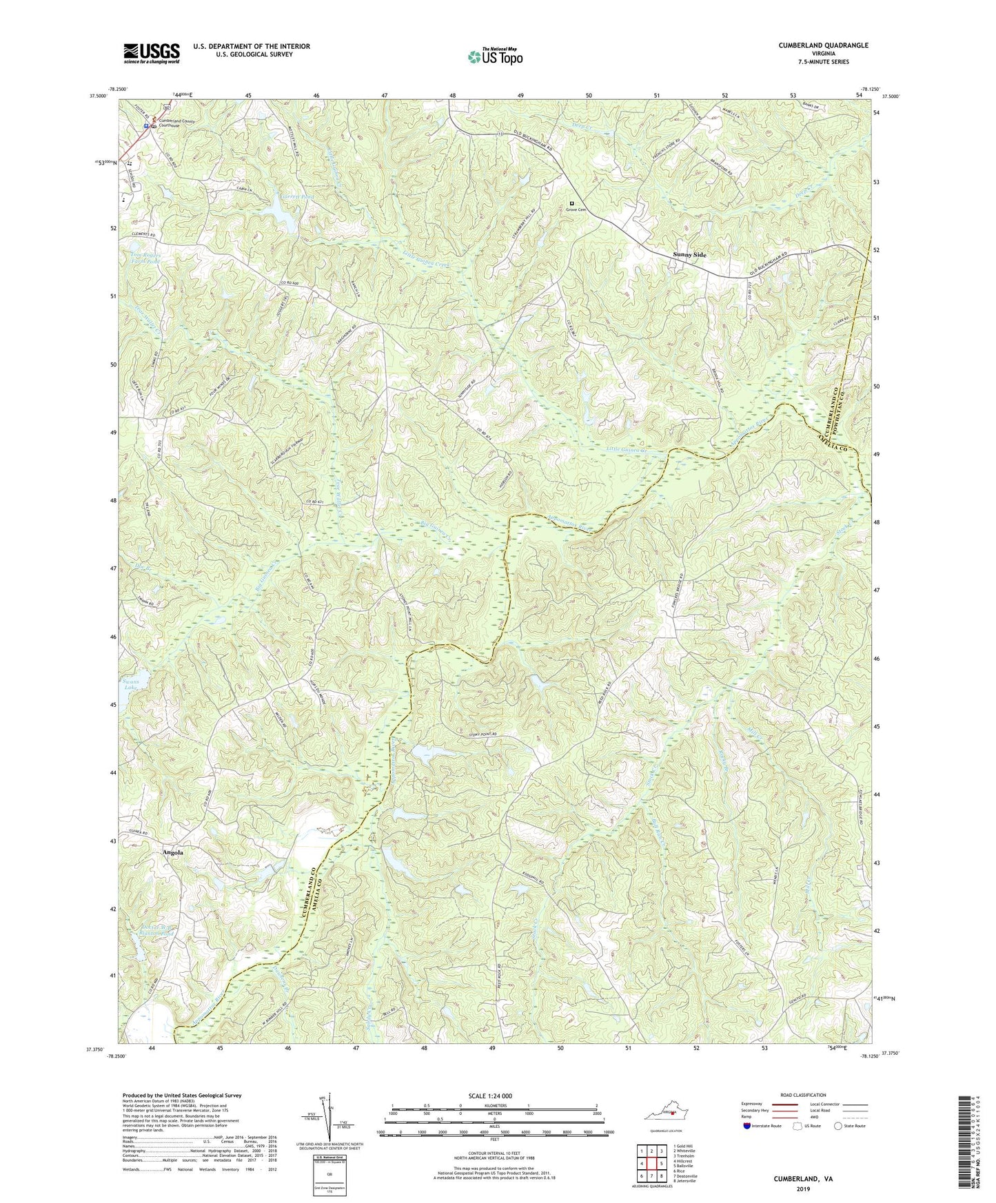
2019 topographic map quadrangle Cumberland in the state of Virginia. Scale: 1:24000. Based on the newly updated USGS 7.5' US Topo map series, this map is in the following counties: Cumberland, Amelia, Powhatan. The map contains contour data, water features, and other items you are used to seeing on USGS maps, but also has updated roads and other features. This is the next generation of topographic maps. Printed on high-quality waterproof paper with UV fade-resistant inks.
Quads adjacent to this one:
West: Hillcrest
Northwest: Gold Hill
North: Whiteville
Northeast: Trenholm
East: Ballsville
Southeast: Jetersville
South: Deatonville
Southwest: Rice
Contains the following named places: Amelia County Fire Services Coordinator, Angola, Angola Creek, Big Guinea Creek, Bull Run Creek, Cedar Fork School, Center Church, Center Union Church, Chesapeake Corporation Dam, Chester Grove Church, Cumberland, Cumberland County Courthouse, Cumberland County Elementary School, Cumberland County High School, Cumberland County Sheriff's Office, Cumberland Post Office, Dawsons Creek, District 3, Doctor W B Blanton Dam, Doctor W B Blanton Pond, Doe Branch, Felixville, Fitzgerald Church, Garrett Dam, Garrett Pond, Grove Cemetery, Grove Church, Jamerson Dam, Little Guinea Creek, Mill Creek, Payne Church, Rerock Church, Rocky Branch, Rocky Mount Church, Rogers Dam, Sandy Creek, Stony Point Mills, Sunny Side, Swans Dam, Tear Wallet Creek, Tom Rogers Farm Pond