MyTopo
Trenholm Virginia US Topo Map
Couldn't load pickup availability
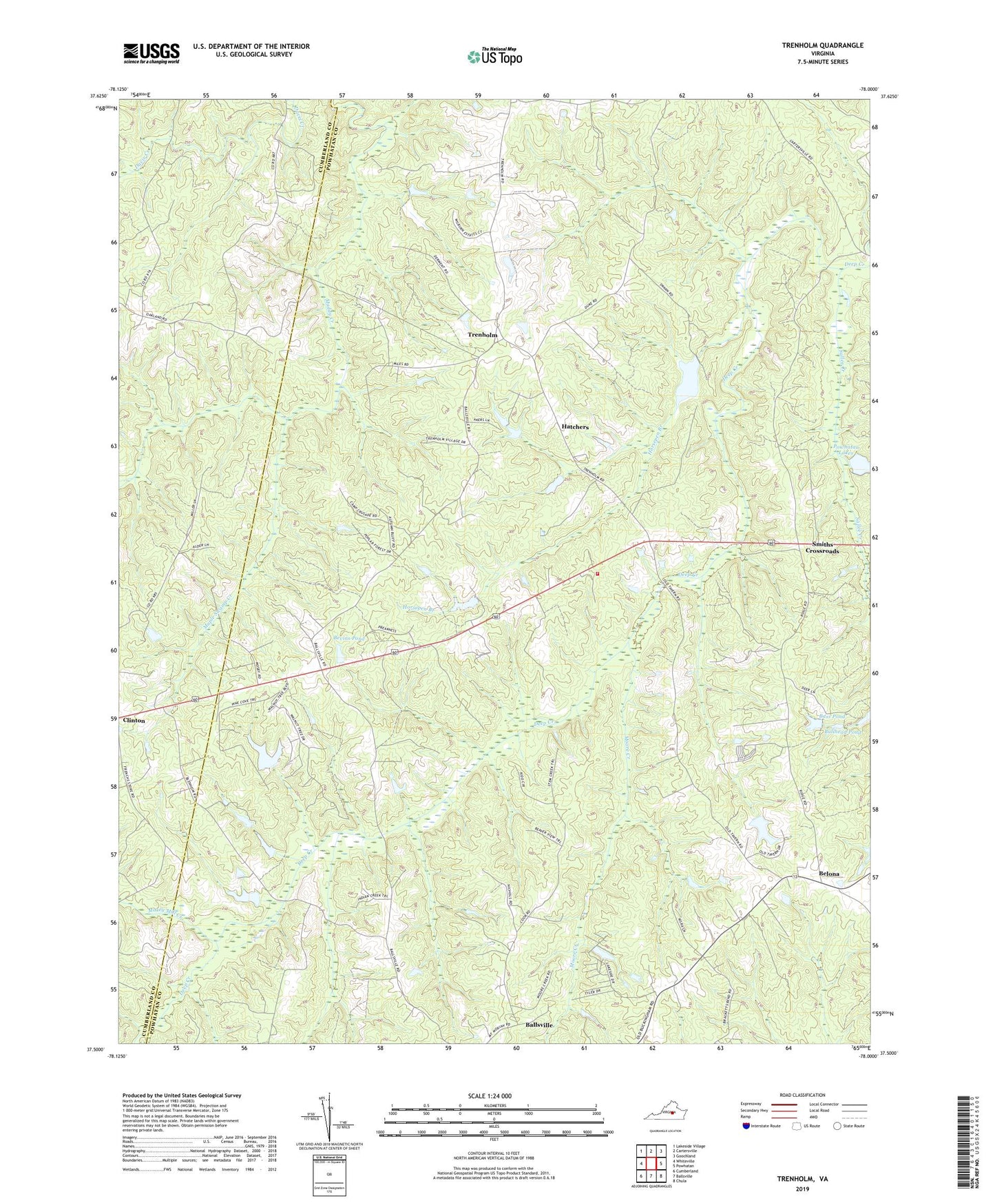
2022 topographic map quadrangle Trenholm in the state of Virginia. Scale: 1:24000. Based on the newly updated USGS 7.5' US Topo map series, this map is in the following counties: Powhatan, Cumberland. The map contains contour data, water features, and other items you are used to seeing on USGS maps, but also has updated roads and other features. This is the next generation of topographic maps. Printed on high-quality waterproof paper with UV fade-resistant inks.
Quads adjacent to this one:
West: Whiteville
Northwest: Lakeside Village
North: Cartersville
Northeast: Goochland
East: Powhatan
Southeast: Chula
South: Ballsville
Southwest: Cumberland
This map covers the same area as the classic USGS quad with code o37078e1.
Contains the following named places: Bass Pond, Belona, Bevins Pond, Bevins Pond Dam, Bullhead Pond, District 5, Hatchers, Hatchers Dairy Farm, Hideaway Lake, Horsepen Branch, Little Zion Church, Lower Powhatan Dam, Lower Powhatan Lake, Maple Swamp Creek, Maxey Mill Creek, Moore Creek, Mount Moriah Church, Mount Pero Church, Mount Zion Baptist Church, Muddy Creek Church, Nixons Dam, Noname Number 14529 Dam, Powhatan County Fire Department Company 5 - Deep Creek Volunteer Fire, Powhatan Lakes, Providence Church, Redford Dam, Redford Pond, Sallee Creek, Smiths Crossroads, Stegers Creek, Trenholm, Williss Dam