MyTopo
Manry Virginia US Topo Map
Couldn't load pickup availability
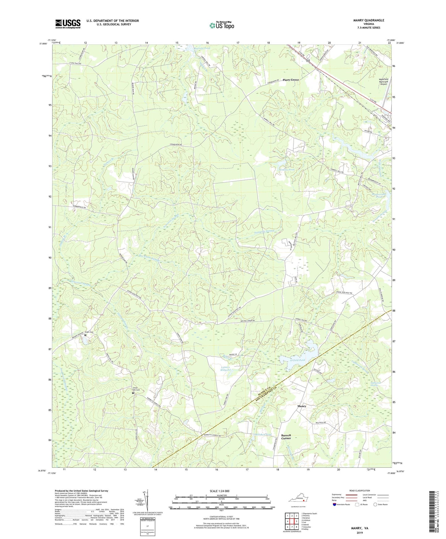
2022 topographic map quadrangle Manry in the state of Virginia. Scale: 1:24000. Based on the newly updated USGS 7.5' US Topo map series, this map is in the following counties: Sussex, Southampton. The map contains contour data, water features, and other items you are used to seeing on USGS maps, but also has updated roads and other features. This is the next generation of topographic maps. Printed on high-quality waterproof paper with UV fade-resistant inks.
Quads adjacent to this one:
West: Littleton
Northwest: Disputanta South
North: Waverly
Northeast: Dendron
East: Ivor
Southeast: Sedley
South: Vicksville
Southwest: Sebrell
This map covers the same area as the classic USGS quad with code o36077h1.
Contains the following named places: Airfield Dam, Airfield Pond, Barrett Corner, Barretts Church, Big Woods State Forest, Big Woods Swamp, Big Woods Wildlife Management Area, Brittles Dam, Brittles Millpond, Burton Grove Church, Cashs Corner, Drumwright Pond, Drumwrights Mill, Elam Cemetery, Elam Church, German Swamp, Harrells Pond, Hebron Church, Jenkins Dam, Jenkins Pond, Laniers Millpond, Lightwood Swamp, Manry, Mill Run, Mill Run Pond, Old Elem Church, Parkers Branch, Piney Grove, Piney Grove Church, Piney Grove School, Quaker Branch, Seacorrie Swamp, Spiveys Store, Union Hill Cemetery, Union Hill Church, Wakefield Community Hunt Club, Wakefield District, Wakefield Municipal Airport, Willis Branch