MyTopo
Drewryville Virginia US Topo Map
Couldn't load pickup availability
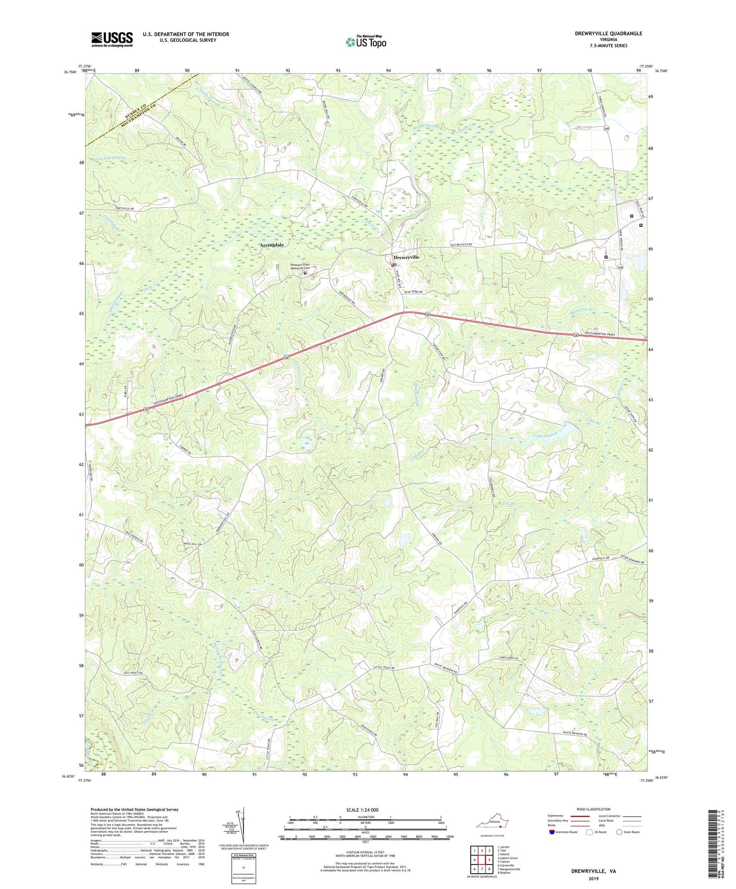
2019 topographic map quadrangle Drewryville in the state of Virginia. Scale: 1:24000. Based on the newly updated USGS 7.5' US Topo map series, this map is in the following counties: Southampton, Sussex, Greensville. The map contains contour data, water features, and other items you are used to seeing on USGS maps, but also has updated roads and other features. This is the next generation of topographic maps. Printed on high-quality waterproof paper with UV fade-resistant inks.
Quads adjacent to this one:
West: Adams Grove
Northwest: Jarratt
North: Yale
Northeast: Sebrell
East: Capron
Southeast: Boykins
South: Margarettsville
Southwest: Claresville
Contains the following named places: Applewhite Swamp, Arringdale, Bellyache Swamp, Chatman Branch, Claud Dam, Cobb Branch, Deerfield Work Center for Women, Drewryville, Drewryville District, Drewryville District School, Drewryville Post Office, Drewryville Volunteer Fire Department Station 7, Fox Branch, Franks Branch, Hebron Church, Musgrave Branch, Nicholson Creek, Pearsons Mill Pond, Persons Church, Pleasant Plain Church, Pleasant Plain Memorial Cemetery, Popes Millpond, Poplar Swamp, Saint Lukes Church, Smith Swamp, Southampton Correctional Center, Southampton Correctional Center Airport, Southampton Men's Detention Center, Southampton State Correctional Farm, Thomas Memorial Church, White Meadow School, ZIP Code: 23844