MyTopo
Claresville Virginia US Topo Map
Couldn't load pickup availability
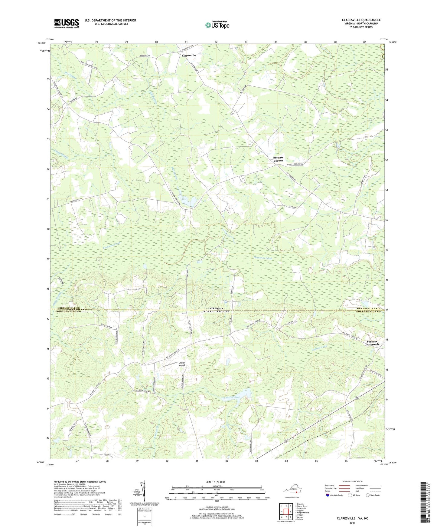
2022 topographic map quadrangle Claresville in the states of Virginia, North Carolina. Scale: 1:24000. Based on the newly updated USGS 7.5' US Topo map series, this map is in the following counties: Greensville, Northampton, Southampton. The map contains contour data, water features, and other items you are used to seeing on USGS maps, but also has updated roads and other features. This is the next generation of topographic maps. Printed on high-quality waterproof paper with UV fade-resistant inks.
Quads adjacent to this one:
West: Skippers
Northwest: Emporia
North: Adams Grove
Northeast: Drewryville
East: Margarettsville
Southeast: Galatia
South: Jackson
Southwest: Weldon
This map covers the same area as the classic USGS quad with code o36077e4.
Contains the following named places: Bryants Corner, Bryants Dam, Caney Swamp, Claresville, Concord Church, District 1, Fountain Grove Church, Gaskins, Gilahi Farm, Glover Airport, Ivy Creek, Jacks Swamp, Jordans Millpond, Mill Swamp, Morris Hill Church, Mount Zion Church, Saint Andrews Church, Taylors Millpond, Turners Crossroads, Vincents School, Zion District