MyTopo
Adams Grove Virginia US Topo Map
Couldn't load pickup availability
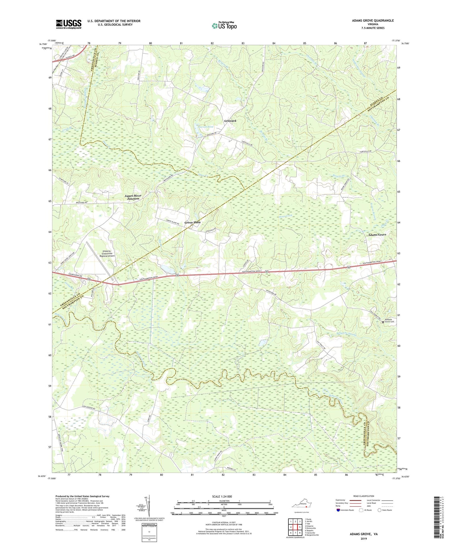
2022 topographic map quadrangle Adams Grove in the state of Virginia. Scale: 1:24000. Based on the newly updated USGS 7.5' US Topo map series, this map is in the following counties: Southampton, Greensville, Sussex. The map contains contour data, water features, and other items you are used to seeing on USGS maps, but also has updated roads and other features. This is the next generation of topographic maps. Printed on high-quality waterproof paper with UV fade-resistant inks.
Quads adjacent to this one:
West: Emporia
Northwest: Purdy
North: Jarratt
Northeast: Yale
East: Drewryville
Southeast: Margarettsville
South: Claresville
Southwest: Skippers
This map covers the same area as the classic USGS quad with code o36077f4.
Contains the following named places: Adams Grove, Big Branch, Browns Branch, Caney Branch, Claresville Church, Emporia Country Club, Emporia-Greensville Regional Airport, Faison School, Faisons Mobile Home Park, Friendship Church of God in Christ, Green Plain, Grizzard, Grizzard School, Harrell Pond, Holly Square School, J B Harrell Dam, James River Junction, Newsom Grove School, Oak Grove Baptist Church, Otterdam Swamp, Pleasant Grove Cemetery, Pleasant Grove Church, Uriah Branch