MyTopo
Jarratt Virginia US Topo Map
Couldn't load pickup availability
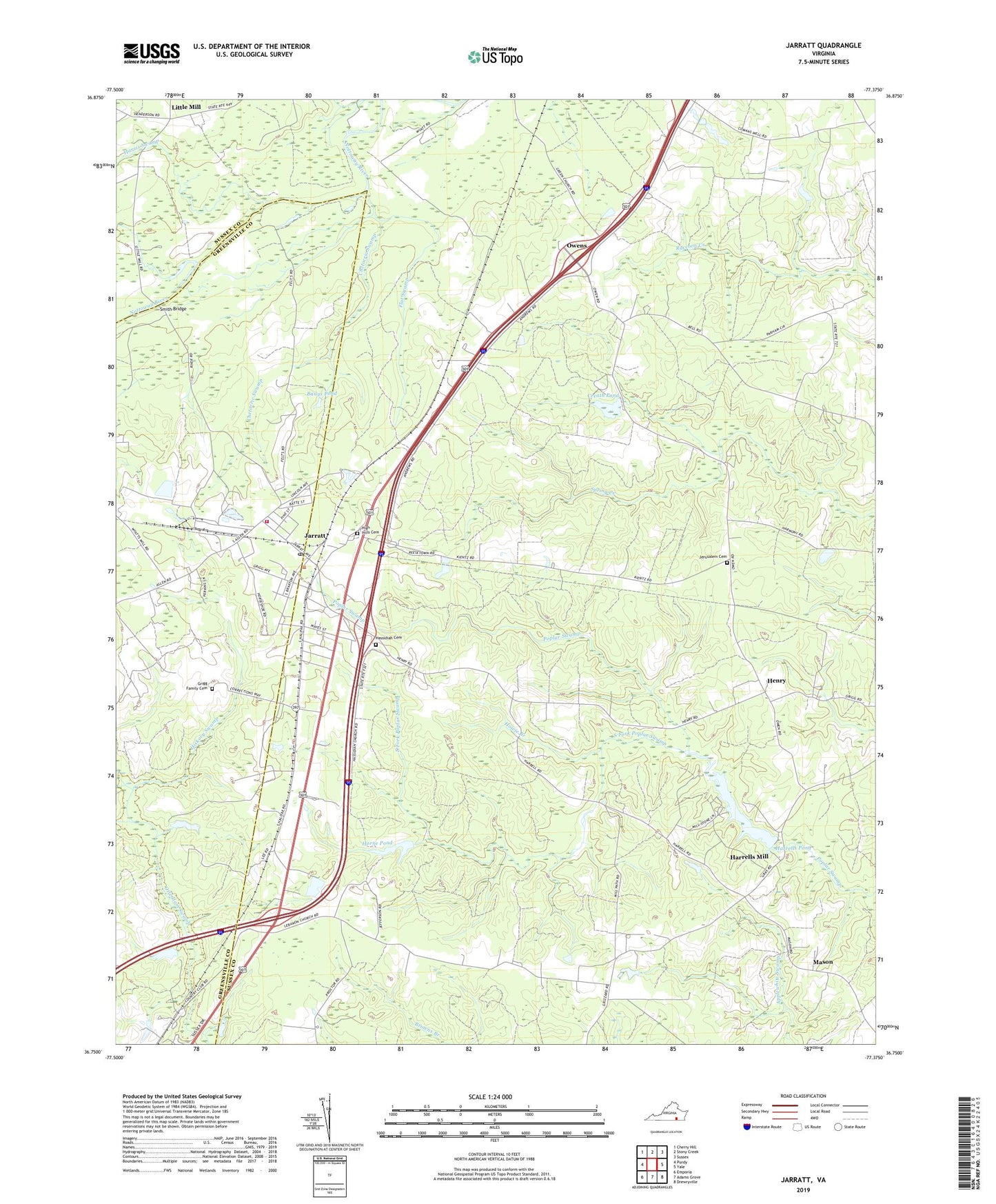
2022 topographic map quadrangle Jarratt in the state of Virginia. Scale: 1:24000. Based on the newly updated USGS 7.5' US Topo map series, this map is in the following counties: Sussex, Greensville. The map contains contour data, water features, and other items you are used to seeing on USGS maps, but also has updated roads and other features. This is the next generation of topographic maps. Printed on high-quality waterproof paper with UV fade-resistant inks.
Quads adjacent to this one:
West: Purdy
Northwest: Cherry Hill
North: Stony Creek
Northeast: Sussex
East: Yale
Southeast: Drewryville
South: Adams Grove
Southwest: Emporia
This map covers the same area as the classic USGS quad with code o36077g4.
Contains the following named places: Bailys Pond, Bethlehem Church, Centenary United Methodist Church, Chapel Hill Church, Chetocric Swamp, Creath Dam, Creath Pond, Creath School, First Baptist Church, Greensville Correctional Center, Greensville Correctional Center Unit, Grigg Family Cemetery, Harrells Dam, Harrells Mill, Harrells Pond, Harris Swamp, Hasadiah Church, Hassidiah Cemetery, Henry, Henry District, Hickory Swamp, High Hill Church, High Hills Cemetery, Holy Trinity Episcopal Church, Horne Dam, Horne Pond, Howie Branch, Jarratt, Jarratt Post Office, Jarratt School, Jarratt Volunteer Fire Department, Jefferson Elementary School, Jerusalem Cemetery, Jerusalem Church, Lebanon Church, Little Mill, Loco School, Magnums Mobile Home Park, Mason, Morning Star Church, Otterdam Mobile Home Park, Owens, Pine View Greenhouses, Saint Johns Church, Smith Bridge, South Fork Poplar Swamp, Town of Jarratt, ZIP Code: 23867