MyTopo
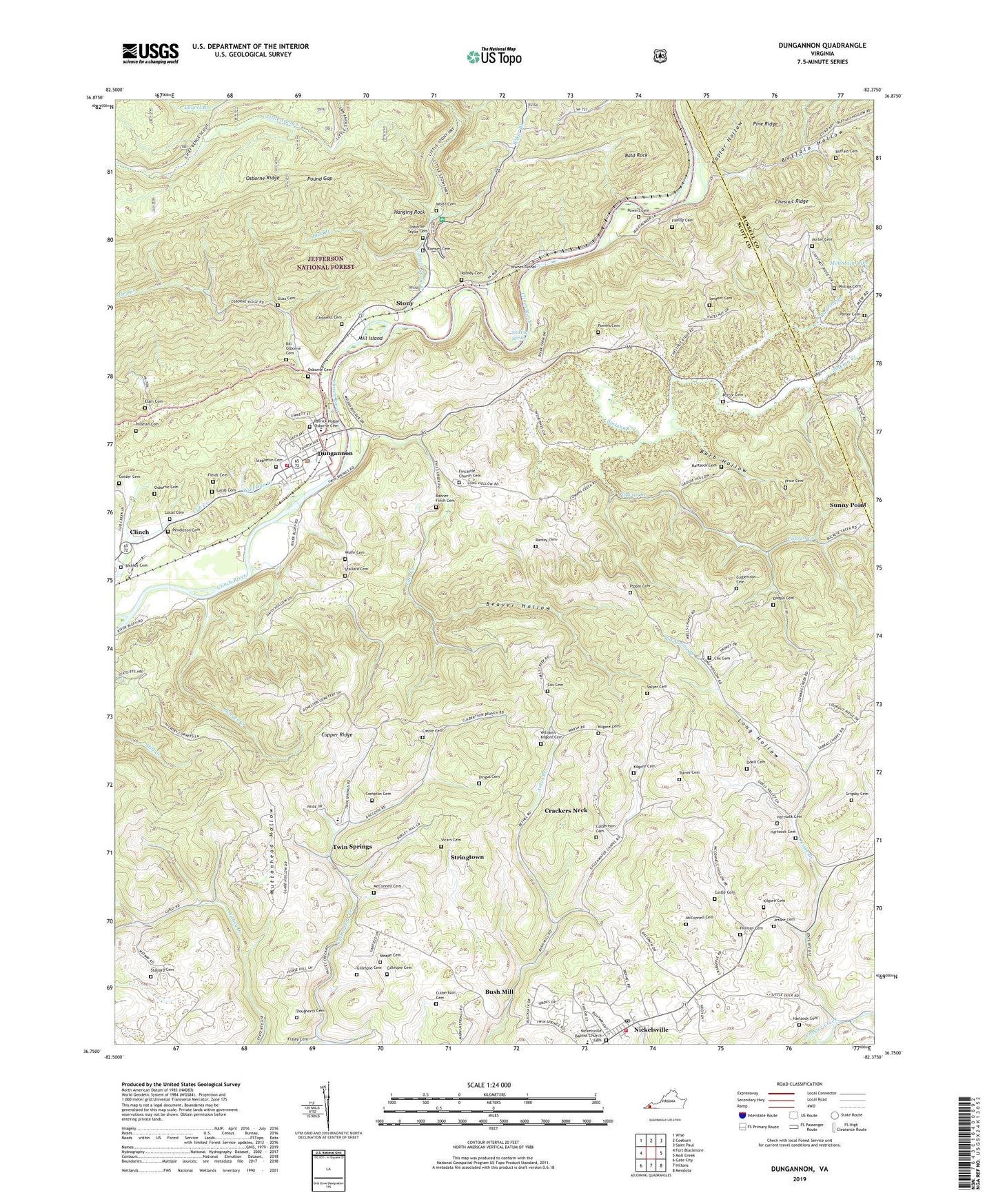
Dungannon Virginia US Topo Map
Couldn't load pickup availability
Also explore the Dungannon Forest Service Topo of this same quad for updated USFS data
2022 topographic map quadrangle Dungannon in the state of Virginia. Scale: 1:24000. Based on the newly updated USGS 7.5' US Topo map series, this map is in the following counties: Scott, Russell. The map contains contour data, water features, and other items you are used to seeing on USGS maps, but also has updated roads and other features. This is the next generation of topographic maps. Printed on high-quality waterproof paper with UV fade-resistant inks.
Quads adjacent to this one:
West: Fort Blackmore
Northwest: Wise
North: Coeburn
Northeast: Saint Paul
East: Moll Creek
Southeast: Mendota
South: Hiltons
Southwest: Gate City
This map covers the same area as the classic USGS quad with code o36082g4.
Contains the following named places: Baker Branch, Bald Rock, Banner - Finch Cemetery, Barb Hollow, Beaver Hollow, Benges Creek, Bickley Cemetery, Big Spring Branch, Bill Osborne Cemetery, Buffalo Cemetery, Buffalo Church, Buffalo Hollow, Bush Mill, Castle Cemetery, Chestnut Ridge, Childress Cemetery, Clinch, Compton Cemetery, Corder Cemetery, Cowan Creek, Cox Cemetery, Crackers Neck, Culbertson Cemetery, Culbertson Chapel, Dingus Cemetery, Dockery Chapel, Dougherty Cemetery, Dry Creek, Dungannon, Dungannon Intermediate School, Dungannon Post Office, Dungannon Volunteer Fire Department, Elam Cemetery, Fall Creek, Family Cemetery, Fields Cemetery, Fincastle Church, Fincastle Church Cemetery, Garfield School, Gillenwater Chapel, Gillespie Cemetery, Grigbys Store, Grigsby Cemetery, Hanging Rock, Hanging Rock Recreation Site, Hartsock Cemetery, Hillman Cemetery, Jack Branch, Jessee Branch, Jessee Cemetery, Kerns Chapel, Kilgore Cemetery, Little Stony Creek, Long Hollow, Lucas Cemetery, McConnell Cemetery, Meade Cemetery, Meades Chapel, Mighty Branch, Mill Island, Miller Yard, Mountain Lake, Mountain View School, Muttonhead Hollow, New Bethel Church, New Bethel School, Nickelsville, Nickelsville Baptist Church Cemetery, Nickelsville Elementary School, Nickelsville Post Office, Nickelsville Rescue Squad, Nickelsville Volunteer Fire Department, Odell Cemetery, Old Rocklands School, Osborne Cemetery, Osborne-Taylor Cemetery, Patrick Hogan Osborne Cemetery, Pendleton Cemetery, Pentecostal Church, Phillips Cemetery, Pippin Cemetery, Point Truth Church, Poplar Hollow, Porter Cemetery, Pound Gap, Powers Cemetery, Price Cemetery, Ramey Cemetery, Ramsey Cemetery, Roaring Branch, Salyer Cemetery, Scott County Life Saving Crew, Sergent Cemetery, Sinking Creek, Sinking Creek Church, Sinking Spring, Sluss Cemetery, Stallard Cemetery, Stapleton Cemetery, Stony, Stringtown, Sunny Point, Thompson Ford, Titan Run, Town of Dungannon, Town of Nickelsville, Townes Tunnel, Turner Cemetery, Twin Springs, Twin Springs High School, Twin Springs School, Vicars Cemetery, Virginia State Prison Camp, Wells Chapel, Williams-Kilgore Cemetery, Wolf Run Creek, Wolfe Cemetery