MyTopo
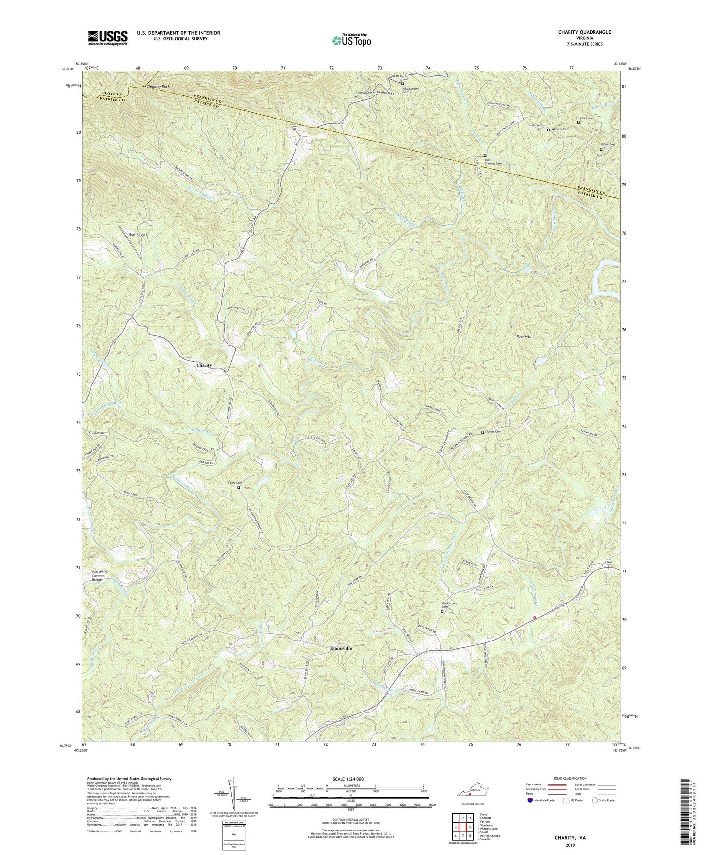
Charity Virginia US Topo Map
Couldn't load pickup availability
2022 topographic map quadrangle Charity in the state of Virginia. Scale: 1:24000. Based on the newly updated USGS 7.5' US Topo map series, this map is in the following counties: Patrick, Franklin, Floyd. The map contains contour data, water features, and other items you are used to seeing on USGS maps, but also has updated roads and other features. This is the next generation of topographic maps. Printed on high-quality waterproof paper with UV fade-resistant inks.
Quads adjacent to this one:
West: Woolwine
Northwest: Floyd
North: Endicott
Northeast: Ferrum
East: Philpott Lake
Southeast: Sanville
South: Patrick Springs
Southwest: Stuart
This map covers the same area as the classic USGS quad with code o36080g2.
Contains the following named places: Bob White Covered Bridge, Buffalo Creek, Bush Airport, Buttermilk Branch, Cecils Dam, Charity, Chimney Rock, Deep Run Camp Area, Elamsville, Fairview Church, Fairview Goodwill Church, Fairystone Volunteer Fire Department, Foley Cemetery, Goblintown Cemetery, Goblintown Church, Goodwill Church, Holly Cemetery, Ironbell Church, Joint Crack Creek, Little Goblintown Creek, Little Sycamore Creek, Little Widgeon Creek, McAlexander Cemetery, Moran Cemetery, Old Ironbell Church, Outdoor Recreations Dam, Poor Mountain, Poplar Camp Creek, Puppy Creek, Rakes Cemetery, Rakes-Thomas Cemetery, Rock Castle Creek, Ross-Harbour Church, Shooting Creek, Small Creek, Smith River Church, Smith River District, Sycamore Creek, Thomas Cemetery, Turkeycock Branch, Turner Cemetery, White Falls, White Oak Creek, Whorley Cemetery, Widgeon Creek