MyTopo
Esmont Virginia US Topo Map
Couldn't load pickup availability
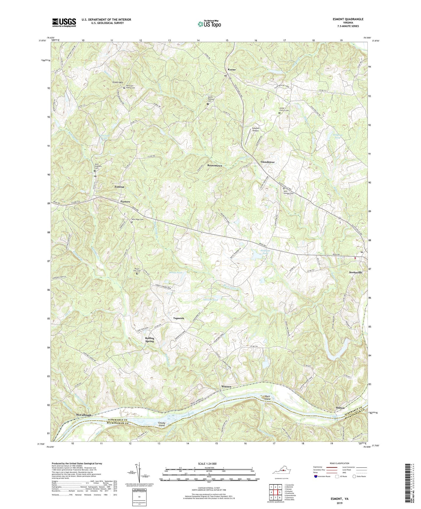
2019 topographic map quadrangle Esmont in the state of Virginia. Scale: 1:24000. Based on the newly updated USGS 7.5' US Topo map series, this map is in the following counties: Albemarle, Buckingham. The map contains contour data, water features, and other items you are used to seeing on USGS maps, but also has updated roads and other features. This is the next generation of topographic maps. Printed on high-quality waterproof paper with UV fade-resistant inks.
Quads adjacent to this one:
West: Schuyler
Northwest: Covesville
North: Alberene
Northeast: Simeon
East: Scottsville
Southeast: Diana Mills
South: Glenmore
Southwest: Howardsville
Contains the following named places: Allmans Dam, Allmans Pond, B F Yancey Elementary School, Ballinger Creek, Boiling Spring, Brokenborough Creek, Brownton, Browntown, Christ Church, Christ Church Cemetery, Dawson Mill, Delutz Dam, Delutz Pond, Donegal, Esmont, Esmont Census Designated Place, Esmont Estate, Esmont Post Office, Fair View, Fallsburg Creek, Glendower, Goosby Island, Grayson Airport, Green Mountain, Hatton, Hatton School, Hattons Ferry, Joe Creek, Keene, Keene Post Office, McCullough, Mill Creek, Miller Creek, Mount Pleasant Cemetery, Mount Pleasant Church, Mount Pleasant School, Mount Zion Cemetery, Mount Zion Church, New Green Mountain Church, New Hope Cemetery, New Hope Church, Nydrie Farms, Old Woodville, Pine Knot, Plain Dealing, Porters, Ramsey Creek, Rock Castle Creek, Rock Island, Rock Island Creek, Saint Georges Cemetery, Saint Johns Church, Saint Stephens Cemetery, Saint Stephens Church, Scotland Farm, Scottsville Elementary School, Scottsville Post Office, Scottsville Recreation Center, Scottsville Shopping Center, Scottsville Volunteer Fire Department, Scottsville Volunteer Rescue Squad Rescue 7, Southside Community Health Center, Stillfreds Dam, Stillfreds Pond, Stillfried Dam, Stillfried Pond, Tapscott, Totier Creek Dam, Totier Creek Farm, Totier Creek Reservoir, Totier Creek Reservoir Park, Totier Hills, Valmont, Valmont Estates, Van Clief Family Cemetery, Vanclieffs Dam, Vanclieffs Lake, Warren, Warren Mill, Warren School, Wolftrap Branch, ZIP Codes: 22937, 22946