MyTopo
Schuyler Virginia US Topo Map
Couldn't load pickup availability
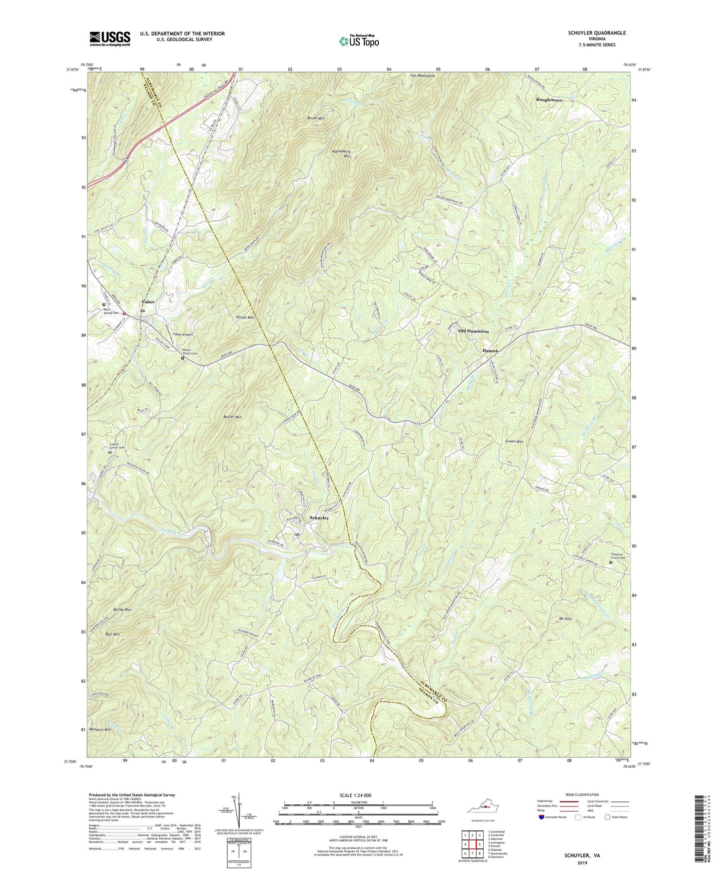
2022 topographic map quadrangle Schuyler in the state of Virginia. Scale: 1:24000. Based on the newly updated USGS 7.5' US Topo map series, this map is in the following counties: Albemarle, Nelson. The map contains contour data, water features, and other items you are used to seeing on USGS maps, but also has updated roads and other features. This is the next generation of topographic maps. Printed on high-quality waterproof paper with UV fade-resistant inks.
Quads adjacent to this one:
West: Lovingston
Northwest: Greenfield
North: Covesville
Northeast: Alberene
East: Esmont
Southeast: Glenmore
South: Howardsville
Southwest: Shipman
This map covers the same area as the classic USGS quad with code o37078g6.
Contains the following named places: Appleberry Mountain, Bailey Mountain, Bear Creek, Bethel Church, Bolling Siding, Briar Fork, Brush Mountain, Bungletown, Butler Mountain, Centenary Church, Chestnut Grove Cemetery, Chestnut Grove Church, Chestnut Grove School, Cove Valley Dam, Curds Ford, Damon, Dutch Creek, Faber, Faber Airport, Faber Post Office, Faber Volunteer Fire Department, Green Creek, Green Mountain, Harris Bridge, Harris Creek, Hickory Creek, Hog Creek, Ivy Creek, Kleinburg School, Locust Grove Cemetery, Locust Grove Church, Monasco Mountain, Moses Crossing, Mount Alto, Mount Alto Church, Mount Shiloh Cemetery, Mount Shiloh Church, Nelson County Rescue Squad Station 1 Headquarters, Oak Ridge Church, Oak Ridge School, Old Dominion, Rock Spring Cemetery, Rock Springs Church, Rockfish River Dam, Rocky Branch, Saint Joys Church, Salem Church, Schuyler, Schuyler Census Designated Place, Schuyler Elementary School, Schuyler Post Office, Sharon Church, Sheepneck Branch, Shiloh Mountain, Tillmans, Waltons Mountain Museum, ZIP Code: 22969