MyTopo
Fosters Falls Virginia US Topo Map
Couldn't load pickup availability
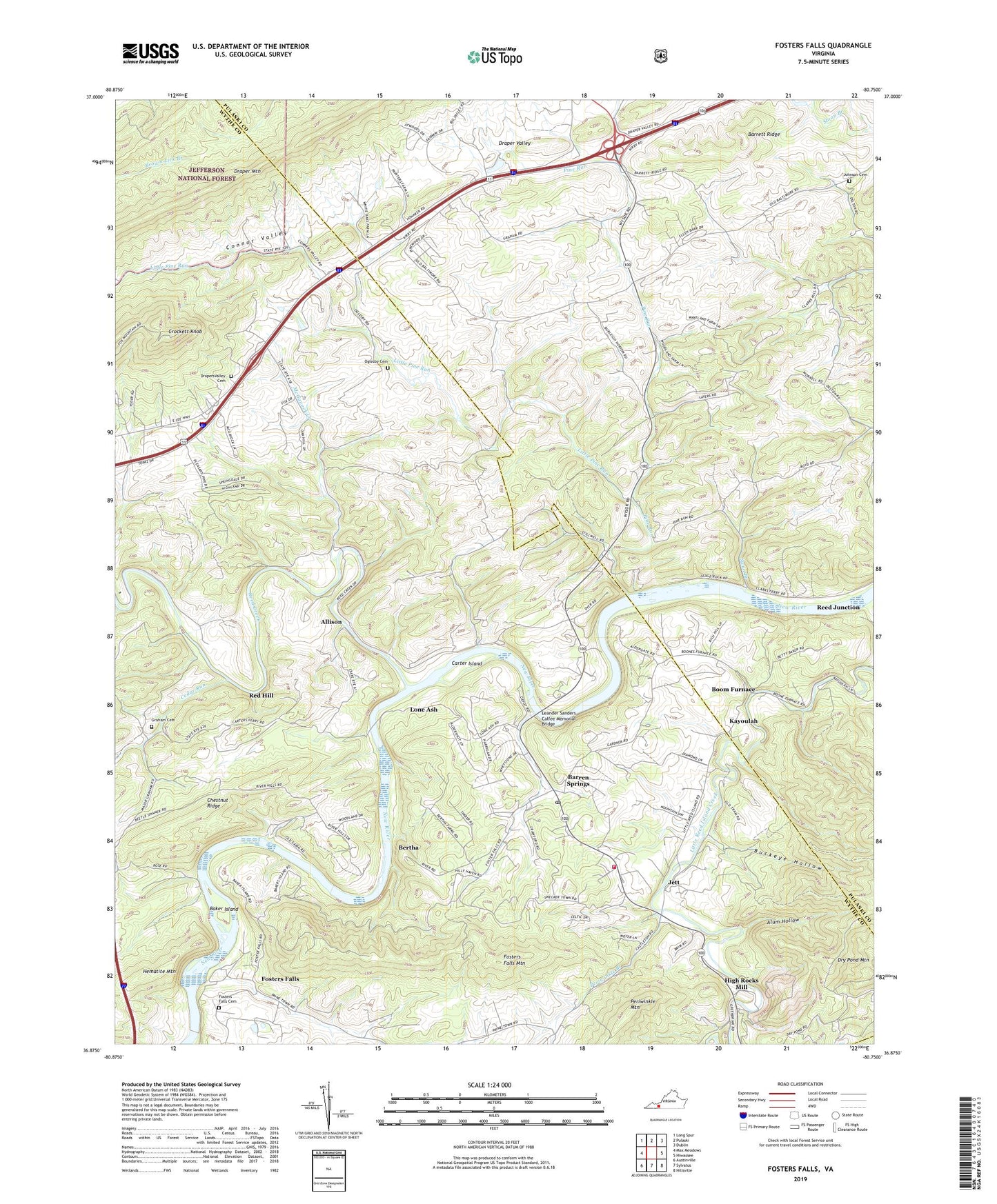
2019 topographic map quadrangle Fosters Falls in the state of Virginia. Scale: 1:24000. Based on the newly updated USGS 7.5' US Topo map series, this map is in the following counties: Wythe, Pulaski, Carroll. The map contains contour data, water features, and other items you are used to seeing on USGS maps, but also has updated roads and other features. This is the next generation of topographic maps. Printed on high-quality waterproof paper with UV fade-resistant inks.
Quads adjacent to this one:
West: Max Meadows
Northwest: Long Spur
North: Pulaski
Northeast: Dublin
East: Hiwassee
Southeast: Hillsville
South: Sylvatus
Southwest: Austinville
Contains the following named places: Allison, Alum Hollow, Baker Island, Barren Springs, Barren Springs Post Office, Barren Springs Station, Barren Springs Volunteer Fire Department, Barrett Ridge, Bertha, Boom Furnace, Brick Church, Buckeye Hollow, Buddle, Camp Carry Brook, Carter Ferry, Carter Island, Cedar Run, Charity Church, Chestnut Ridge, Chestnut Ridge School, Clarks Mill Church, Connor Valley, Crockett Knob, Draper Valley, Draper Valley Church, Drapers Valley Cemetery, Foster Falls United Methodist Church, Fosters Falls, Fosters Falls Cemetery, Fosters Falls Mountain, Glenwood, Glenwood Church, Graham Cemetery, Graham School, Hematite Mountain, High Rocks Church, High Rocks Mill, Jett, Johnson Cemetery, Johnson Chapel, Kayoulah, Leander Sanders Calfee Memorial Bridge, Little Pine Run, Lone Ash, Low Gap School, McGavock Creek, Oglesby Cemetery, Oglesby School, Patterson, Periwinkle Branch, Periwinkle Mountain, Pickett Chapel, Pine Run, Pine Run Church, Red Hill, Reed Creek, Reed Junction, Sayer School, Smith Church, Star Cave, Swan Branch, Sylvatus Quarry, ZIP Codes: 24313, 24324