MyTopo
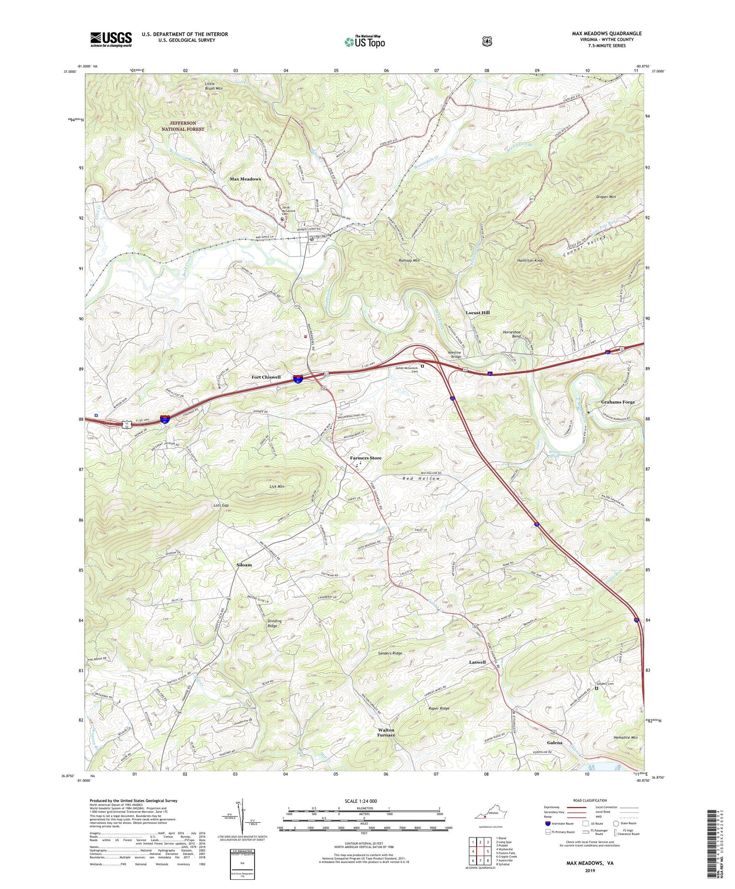
Max Meadows Virginia US Topo Map
Couldn't load pickup availability
Also explore the Max Meadows Forest Service Topo of this same quad for updated USFS data
2022 topographic map quadrangle Max Meadows in the state of Virginia. Scale: 1:24000. Based on the newly updated USGS 7.5' US Topo map series, this map is in the following counties: Wythe. The map contains contour data, water features, and other items you are used to seeing on USGS maps, but also has updated roads and other features. This is the next generation of topographic maps. Printed on high-quality waterproof paper with UV fade-resistant inks.
Quads adjacent to this one:
West: Wytheville
Northwest: Bland
North: Long Spur
Northeast: Pulaski
East: Fosters Falls
Southeast: Sylvatus
South: Austinville
Southwest: Cripple Creek
This map covers the same area as the classic USGS quad with code o36080h8.
Contains the following named places: @Virginia State Police Division 4 Headquarters, 24360, Beaverdam Creek, Boiling Spring, Brown Lick Branch, Carter Wayside, Clarkes Summit, Cleveland Mill, Coal Creek, Coleman Store, Conners, Connor Valley School, Cove Creek, Covenant Christian Academy, Dividing Ridge, Dungeon Branch, East Piney Church, Eastwood Branch, Factory Merchants Mall Shopping Center, Farmers Store, Fort Chiswell, Fort Chiswell Census Designated Place, Fort Chiswell Church, Fort Chiswell District, Fort Chiswell High School, Fort Chiswell Middle School, Galena, Galena Creek, Galena Presbyterian Church, Glade Creek, Graham Branch, Grahams Forge, Grahams Forge United Methodist Church, Gravley Church, Hamilton Knob, Horseshoe Bend, Jacob McGavock Cemetery, James McGavock Cemetery, Keesline Bridge, Kessling School, Laswell, Lead Mines District, Lead Mines Rescue Squad, Little Brush Mountain, Locust Hill, Locust Hill United Methodist Church, Lots Gap, Mathews School, Max Meadows, Max Meadows Census Designated Place, Max Meadows Elementary School, Max Meadows Post Office, Max Meadows Volunteer Fire Department, McGavock Run, Miller Creek, Mount Vale Church, Poletown, Poletown Branch, Ramsay Mountain, Raper Ridge, Red Hollow, Saint Pauls Church, Sanders Cemetery, Sanders Ridge, Sheffey Elementary School, Siloam, Siloam Gospel Tabernacle, Summit Hill Church, Walton Furnace, Walton School, Wytheville National Fish Hatchery Number 2