MyTopo
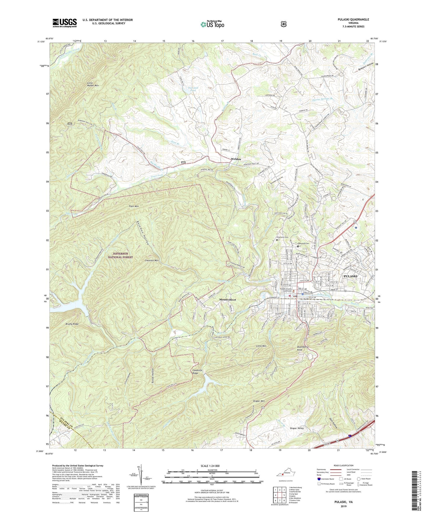
Pulaski Virginia US Topo Map
Couldn't load pickup availability
Also explore the Pulaski Forest Service Topo of this same quad for updated USFS data
2022 topographic map quadrangle Pulaski in the state of Virginia. Scale: 1:24000. Based on the newly updated USGS 7.5' US Topo map series, this map is in the following counties: Pulaski, Wythe. The map contains contour data, water features, and other items you are used to seeing on USGS maps, but also has updated roads and other features. This is the next generation of topographic maps. Printed on high-quality waterproof paper with UV fade-resistant inks.
Quads adjacent to this one:
West: Long Spur
Northwest: Mechanicsburg
North: White Gate
Northeast: Staffordsville
East: Dublin
Southeast: Hiwassee
South: Fosters Falls
Southwest: Max Meadows
This map covers the same area as the classic USGS quad with code o37080a7.
Contains the following named places: Aldergate United Methodist Church, Altoona Branch, Altoona Mines, Anderson Memorial Presbyterian Church, Back Creek School, Back Creek Tabernacle, Bateman Hollow, Bella Vista, Bentley Branch, Big Shuffle Branch, Calfee Park, Calfee Training School, Caseknife Ridge, Central Elementary School, Central School, Chestnut Mountain, Christ Episcopal Church, Church of God, Church of God in Christ, Claremont Elementary School, Clark, Clarks Chapel, Cricket Hollow, Dark Hollow, Dora Hi-Way Church, Draper Valley Church, Dusenberry Knob, East Fork Indian Grave Creek, Eddys Branch, Empire Mine, Fine Arts Center for the New River Valley, First Baptist Church, First Christian Church, First Church of the Brethren, First Pentecostal Holiness Church, First Presbyterian Church, First United Methodist Church, Fortnerfield Branch, Gallimore, Gatewood Dam, Gatewood Reservoir, Glad Tidings Tabernacle, Harbison Branch, Hill Top Church, Hilton Village, Hogan Branch, Hogan Dam, Hogan Lake, Indian Grave Creek, Jackson Park, Jefferson Elementary School, Jordans Chapel, Kegley Farm of Pulaski, Kent Branch, LewisGale Hospital at Pulaski, Little Mountain, Memorial Square Shopping Center, Mount Olivet, Mountain Park Picnic Area, New Century Methodist Church, New Hope Chapel, Northwood Elementary School, Oakwood Cemetery, Pauline Church of Christ, Pentecostal Church of God, Pinehurst Cemetery, Pondlick Branch, Pulaski, Pulaski County Courthouse, Pulaski County Jail, Pulaski County Library, Pulaski County Sheriff's Office, Pulaski Elementary School, Pulaski Fire Department, Pulaski Historic Commercial District, Pulaski Historic Residential District, Pulaski Hospital, Pulaski Middle School, Pulaski Police Department, Pulaski Post Office, Pulaski Wayside Picnic Area, Ray School, Regional Emergency Medical Services Station 5, Robinson District, Rocky Branch, Seagle Church, Stuart Memorial Methodist Church, Thorne Spring Church, Thornhill Dam, Thornhill Pond, Town of Pulaski, Tract Fork, Tract Mountain, Trinity Lutheran Church, Tunnel Hollow, Valley Branch, Valley Road Chapel, WBLB-AM (Pulaski), Weldon, Wildlife Cabin, WPUV-AM (Pulaski), ZIP Code: 24301