MyTopo
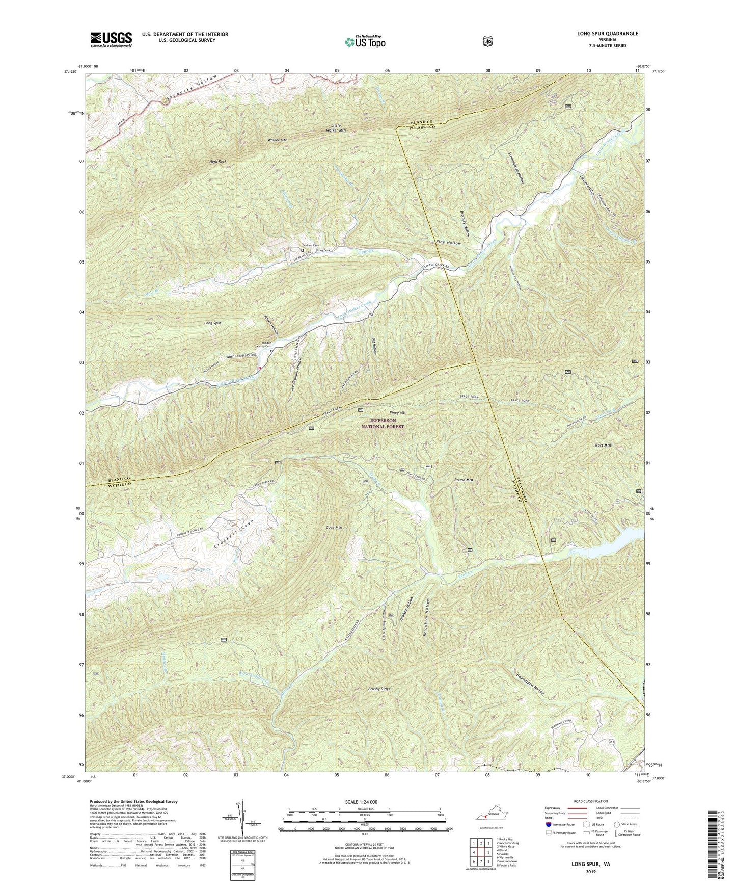
Long Spur Virginia US Topo Map
Couldn't load pickup availability
Also explore the Long Spur Forest Service Topo of this same quad for updated USFS data
2022 topographic map quadrangle Long Spur in the state of Virginia. Scale: 1:24000. Based on the newly updated USGS 7.5' US Topo map series, this map is in the following counties: Wythe, Bland, Pulaski. The map contains contour data, water features, and other items you are used to seeing on USGS maps, but also has updated roads and other features. This is the next generation of topographic maps. Printed on high-quality waterproof paper with UV fade-resistant inks.
Quads adjacent to this one:
West: Bland
Northwest: Rocky Gap
North: Mechanicsburg
Northeast: White Gate
East: Pulaski
Southeast: Fosters Falls
South: Max Meadows
Southwest: Wytheville
This map covers the same area as the classic USGS quad with code o37080a8.
Contains the following named places: Bearwallow Hollow, Big Hollow, Big Spring Branch, Brickkiln Hollow, Bridge Hollow, Bromley Hollow, Brushy Ridge, Church Branch, Cove Mountain, Crow Hollow, Davis Church, Davis Gate Hollow, Davis School, Forks of Road, Goshen Cemetery, Graham Hollow, Gunton Park, Gunton Park Church of God of Prophecy, Hickory Hollow, Hidden Valley Cemetery, High Rock, Hog Rock Hollow, Holston School, Joe Graham Hollow, Laurel Hollow, Laurel Hollow Branch, Little Creek Volunteer Fire Department, Little Lot Hollow, Little Spring Hollow, Long Spur, Long Spur Post Office, Mill Iron Church, Mill Iron School, Panther Lick Hollow, Pine Hollow, Piney Mountain, Raven Hollow, Round Mountain, Schoolhouse Hollow, Spur Branch, Spur Branch School, Sulphur Spring Hollow, Wash Place Hollow, West Fork Miller Creek