
MyTopo
Gladys Virginia US Topo Map
Couldn't load pickup availability
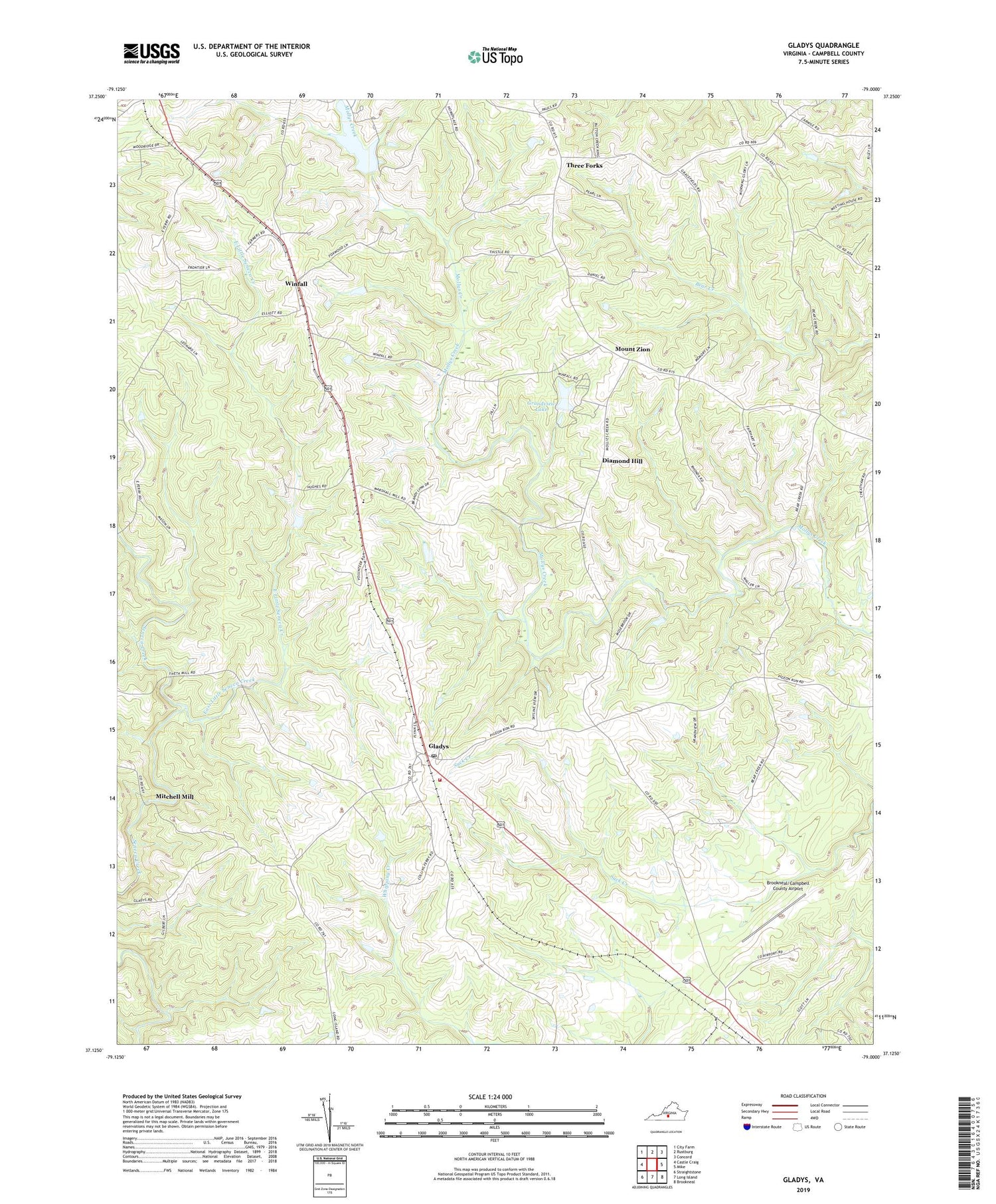
2019 topographic map quadrangle Gladys in the state of Virginia. Scale: 1:24000. Based on the newly updated USGS 7.5' US Topo map series, this map is in the following counties: Campbell. The map contains contour data, water features, and other items you are used to seeing on USGS maps, but also has updated roads and other features. This is the next generation of topographic maps. Printed on high-quality waterproof paper with UV fade-resistant inks.
Quads adjacent to this one:
West: Castle Craig
Northwest: City Farm
North: Rustburg
Northeast: Concord
East: Mike
Southeast: Brookneal
South: Long Island
Southwest: Straightstone
Contains the following named places: Bethel Mennonite School, Brookneal District, Brookneal/Campbell County Airport, Calvary Church, Campbell County, Citizens Emergency Crew, Diamond Hill, East Little Seneca Creek, Farmer Dam, First Saint Pauls Church, Gladys, Gladys Elementary School, Gladys Post Office, Gladys Volunteer Fire Department, Grandview Lake, Grandview Lake Dam, Kedron Church, Mitchell Mill, Mount Zion, New Chapel Church, New Free Spring Church, Oak Grove Church, Organ Chapel, Saint Stephens Church, Seneca School, Three Forks, Wesleybury Church, Winfall, Winfall Nurseries


