
MyTopo
Green Valley Virginia US Topo Map
Couldn't load pickup availability
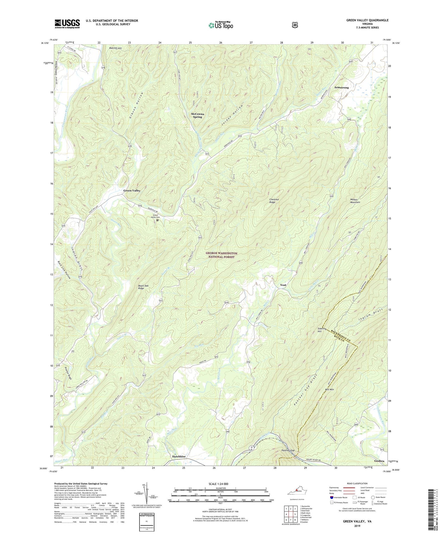
2019 topographic map quadrangle Green Valley in the state of Virginia. Scale: 1:24000. Based on the newly updated USGS 7.5' US Topo map series, this map is in the following counties: Bath, Rockbridge. The map contains contour data, water features, and other items you are used to seeing on USGS maps, but also has updated roads and other features. This is the next generation of topographic maps. Printed on high-quality waterproof paper with UV fade-resistant inks.
Quads adjacent to this one:
West: Bath Alum
Northwest: Burnsville
North: Williamsville
Northeast: Deerfield
East: Craigsville
Southeast: Goshen
South: Millboro
Southwest: Nimrod Hall
Contains the following named places: Armstrong, Black Oak Ridge, Bolshers Run, Buck Lick Hollow, Buck Lick Run, Chestnut Ridge, Cloverdale Presbyterian Church, Fort Lewis, Gates Hollow, Gibson Hollow, Green Valley, Green Valley Cemetery, Green Valley United Methodist Church, Hotchkiss, Indian Draft, John L Lawrence Dam, Jordan Hollow, Laurel Branch, Little Mill Creek, McCowan Spring, Mill Creek Church, Mount Zion Baptist Church, Panther Gap, Panther Gap Draft, Pig Run, Proctor Draft, Rehobeth United Methodist Church, White Sulphur Spring Branch, Yost


