MyTopo
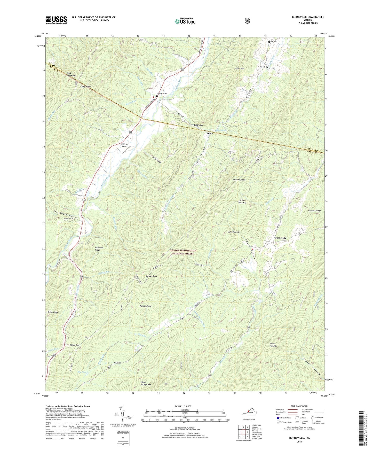
Burnsville Virginia US Topo Map
Couldn't load pickup availability
Also explore the Burnsville Forest Service Topo of this same quad for updated USFS data
2022 topographic map quadrangle Burnsville in the state of Virginia. Scale: 1:24000. Based on the newly updated USGS 7.5' US Topo map series, this map is in the following counties: Bath, Highland. The map contains contour data, water features, and other items you are used to seeing on USGS maps, but also has updated roads and other features. This is the next generation of topographic maps. Printed on high-quality waterproof paper with UV fade-resistant inks.
Quads adjacent to this one:
West: Sunrise
Northwest: Paddy Knob
North: Mustoe
Northeast: Monterey SE
East: Williamsville
Southeast: Green Valley
South: Bath Alum
Southwest: Warm Springs
This map covers the same area as the classic USGS quad with code o38079b6.
Contains the following named places: Barnetts Run, Bath - Highland Burnsville Volunteer Fire Department, Bethel, Big Pond, Big Valley Cemetery, Bolar, Bolar Gap, Bolar Methodist Church, Bolar Run, Bolar Spring, Bolar Volunteer Fire Department, Burnsville, Burnsville United Methodist Church, Cave Run, Chestnut Ridge, Cleeks Mill, Daggy Hollow, Duncan Knob, Duncan Knob Lookout, Duncan Ridge, Fort Lewis Trail, George W Cleek Cemetery, Givens Run, Gulley Run, Gum Tree Mountain, Laurel Run, Little Valley, Little Valley Run, McGuffin Trail, Mill Run, Morris Run, Paddy Bee Tree Run, Peak Run, Piney Ridge, Pritt Hollow, Rocky Ridge, Rocky Run, Set Free Christian Fellowship Church, Singleton Airport, Starr Chapel United Methodist Church, Stillhouse Hollow, Stony Run, Stony Run Cemetery, Stony Run Church, Tower Hill Mountain Trail, Valley Bethel Church, White Rock Mountain, Wilson Mountain