MyTopo
Grottoes Virginia US Topo Map
Couldn't load pickup availability
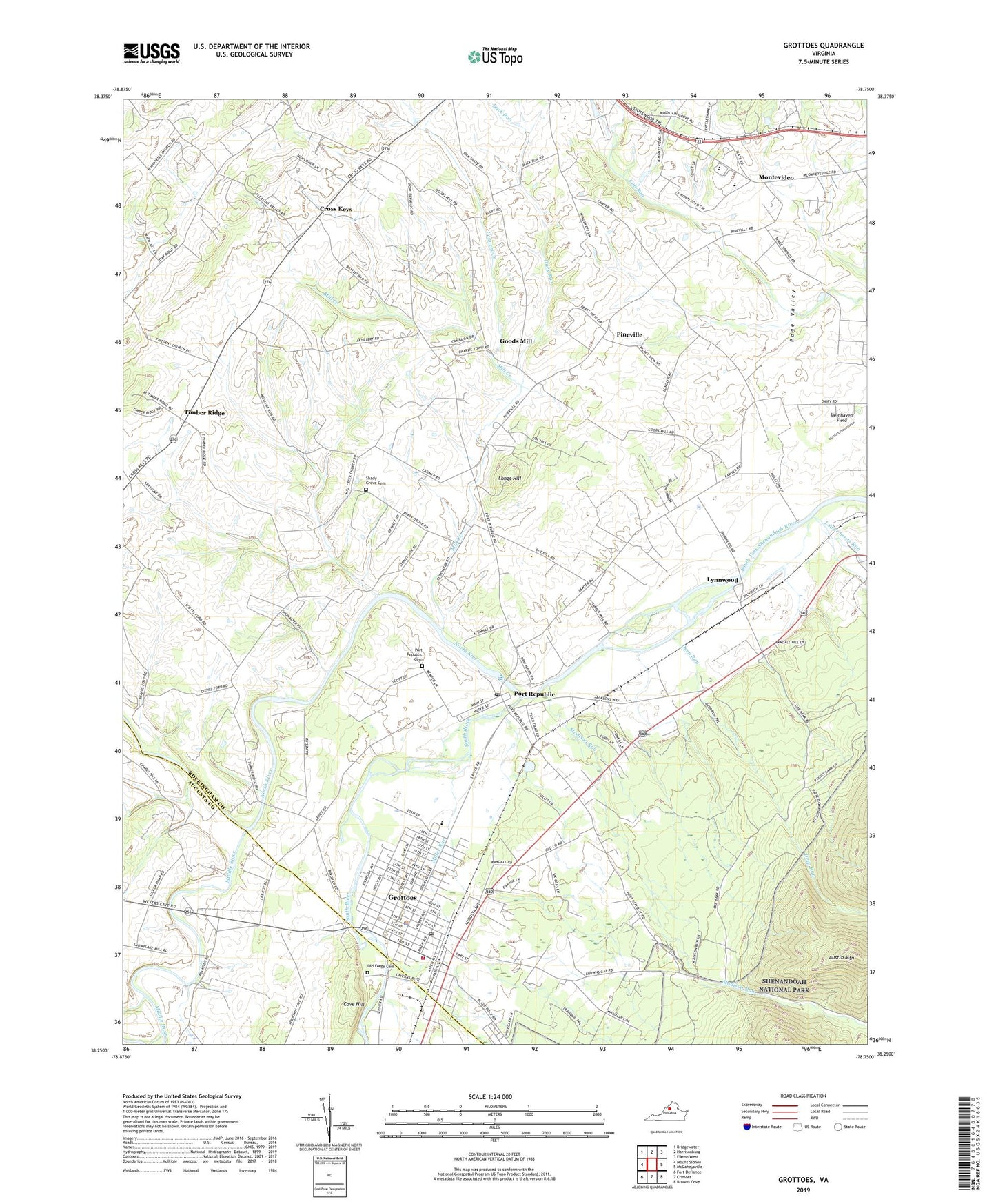
2019 topographic map quadrangle Grottoes in the state of Virginia. Scale: 1:24000. Based on the newly updated USGS 7.5' US Topo map series, this map is in the following counties: Rockingham, Augusta. The map contains contour data, water features, and other items you are used to seeing on USGS maps, but also has updated roads and other features. This is the next generation of topographic maps. Printed on high-quality waterproof paper with UV fade-resistant inks.
Quads adjacent to this one:
West: Mount Sidney
Northwest: Bridgewater
North: Harrisonburg
Northeast: Elkton West
East: McGaheysville
Southeast: Browns Cove
South: Crimora
Southwest: Fort Defiance
Contains the following named places: Austin Mountain, Broad Run, Cave Hill, Congers Creek, Cross Keys, Cross Keys Battle Monument, Cub Run Dairy, Cub Run Elementary School, Deep Run, Duck Run, Goods Mill, Grace Church, Grand Caverns Regional Park, Grottoes, Grottoes Elementary School, Grottoes Police Department, Grottoes Post Office, Grottoes Rescue Squad, Grottoes Volunteer Fire Department, Hickory Nut Poultry Farm, Honey Port Farms, Longs Hill, Lower Lewis Run, Lynnhaven Field, Lynnwood, Madison Run, Middle River, Mill Creek, Mill Creek Church, Miller Run, Montevideo, Montevideo Middle School, Mount Meridian, Mount Olive Church, Mount Vernon Church, Mountain Grove Church, North River, Oakhill Greenhouses, Old Forge Cemetery, Peak View Elementary School, Pineville, Port Republic, Port Republic Battle Monument, Port Republic Cemetery, Port Republic Census Designated Place, Port Republic Elementary School, Port Republic Historic District, Port Republic Post Office, Shady Grove United Brethren Cemetery, Shireland Acres, South River, South River Elementary School, Timber Ridge, Town of Grottoes, Valley Inn Farm, ZIP Code: 24471