MyTopo
Browns Cove Virginia US Topo Map
Couldn't load pickup availability
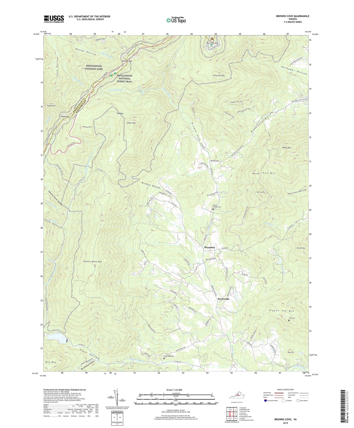
2022 topographic map quadrangle Browns Cove in the state of Virginia. Scale: 1:24000. Based on the newly updated USGS 7.5' US Topo map series, this map is in the following counties: Albemarle, Rockingham, Augusta. The map contains contour data, water features, and other items you are used to seeing on USGS maps, but also has updated roads and other features. This is the next generation of topographic maps. Printed on high-quality waterproof paper with UV fade-resistant inks.
Quads adjacent to this one:
West: Crimora
Northwest: Grottoes
North: McGaheysville
Northeast: Swift Run Gap
East: Free Union
Southeast: Charlottesville West
South: Crozet
Southwest: Waynesboro East
This map covers the same area as the classic USGS quad with code o38078b6.
Contains the following named places: Big Branch, Big Flat Mountain, Blackrock, Blackrock Gap, Blackrock Shelter, Boys Haven, Branch Point, Bray Hill, Brightberry, Browns Cove, Browns Cove Church, Browns Gap, Burnthouse Hollow, Camp Sugar Hollow, Cedar Mountain, Charlottesville Reservoir, Currant Mountain, Doyles River, Doyles River Overlook, Doylesville, Dundo Overlook, Falls Trail, Fox Mountain, Gibson Mountain, High Top Mountain, Innisfree, Jones Run, Jones Run Falls, Little Flat Mountain, Little Gate Branch, Locust Grove Church, Loft Mountain Campgrounds, Luck Hollow, Martins Mountain, Middle Mountain, Mission School, Montfair, Mount Carmel Cemetery, Mount Carmel Church, Mount Carmel School, Mountfair, North Fork Moormans River, Pasture Fence Mountain, Pigeon Top Mountain, Pinestand Mountain, Sandridge Cemetery, Shop Hollow, Shop Run, South Fork Moormans River, Sugar Hollow, Sugar Hollow Dam, Sugar Hollow School, Tate Cemetery, Tobacco House Hollow, Trayfoot Mountain Overlook, Via Gap, Via School, Walnut Level, Wayside Church, White Hall District, Wildcat Hollow, ZIP Code: 22932