MyTopo
Fort Defiance Virginia US Topo Map
Couldn't load pickup availability
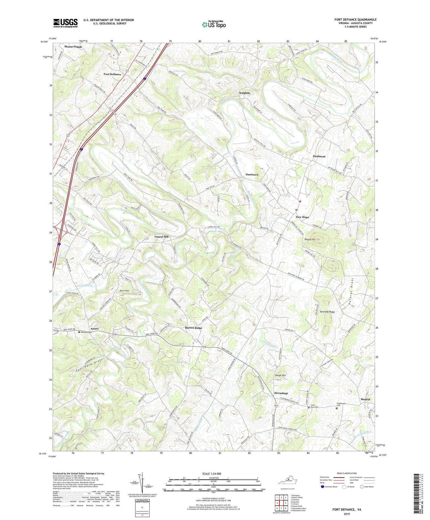
2022 topographic map quadrangle Fort Defiance in the state of Virginia. Scale: 1:24000. Based on the newly updated USGS 7.5' US Topo map series, this map is in the following counties: Augusta. The map contains contour data, water features, and other items you are used to seeing on USGS maps, but also has updated roads and other features. This is the next generation of topographic maps. Printed on high-quality waterproof paper with UV fade-resistant inks.
Quads adjacent to this one:
West: Staunton
Northwest: Parnassus
North: Mount Sidney
Northeast: Grottoes
East: Crimora
Southeast: Waynesboro East
South: Waynesboro West
Southwest: Stuarts Draft
This map covers the same area as the classic USGS quad with code o38078b8.
Contains the following named places: Annex, Asbury Church, Augusta Military Academy, Augusta Stone Church, Barren Ridge, Barren Ridge School, Belmont Cemetery, Centennial School, Christians Creek, Clymore Elementary School, Coleytown Run, Damtown, Fort Defiance, Fort Defiance High School, Full Gospel Church, Hermitage, Hildebrand Cemetery, Hildebrand Church, Kennedy Ridge, Knightly, Laurel Hill, Laurel Hill Baptist Church, Lewis Creek, Madrid, Meadow Run, Middle River Church, Mount Bethel Church, Mount Tabor Church, New Hope, New Hope Census Designated Place, New Hope Elementary School, New Hope Post Office, New Hope United Methodist Church, New Hope Volunteer Fire Department Company 18, North Point Farm, Oak Grove Church, Oak Grove School, Piedmont, Polecat Draft, Poor Farm Draft, Root Field, Rough Hill, Round Hill, Round Hill School, S Gordon Stewart Middle School, Saint James Church, Saint Paul Cemetery, Verona Elementary School, ZIP Codes: 24437, 24482