MyTopo
Hansonville Virginia US Topo Map
Couldn't load pickup availability
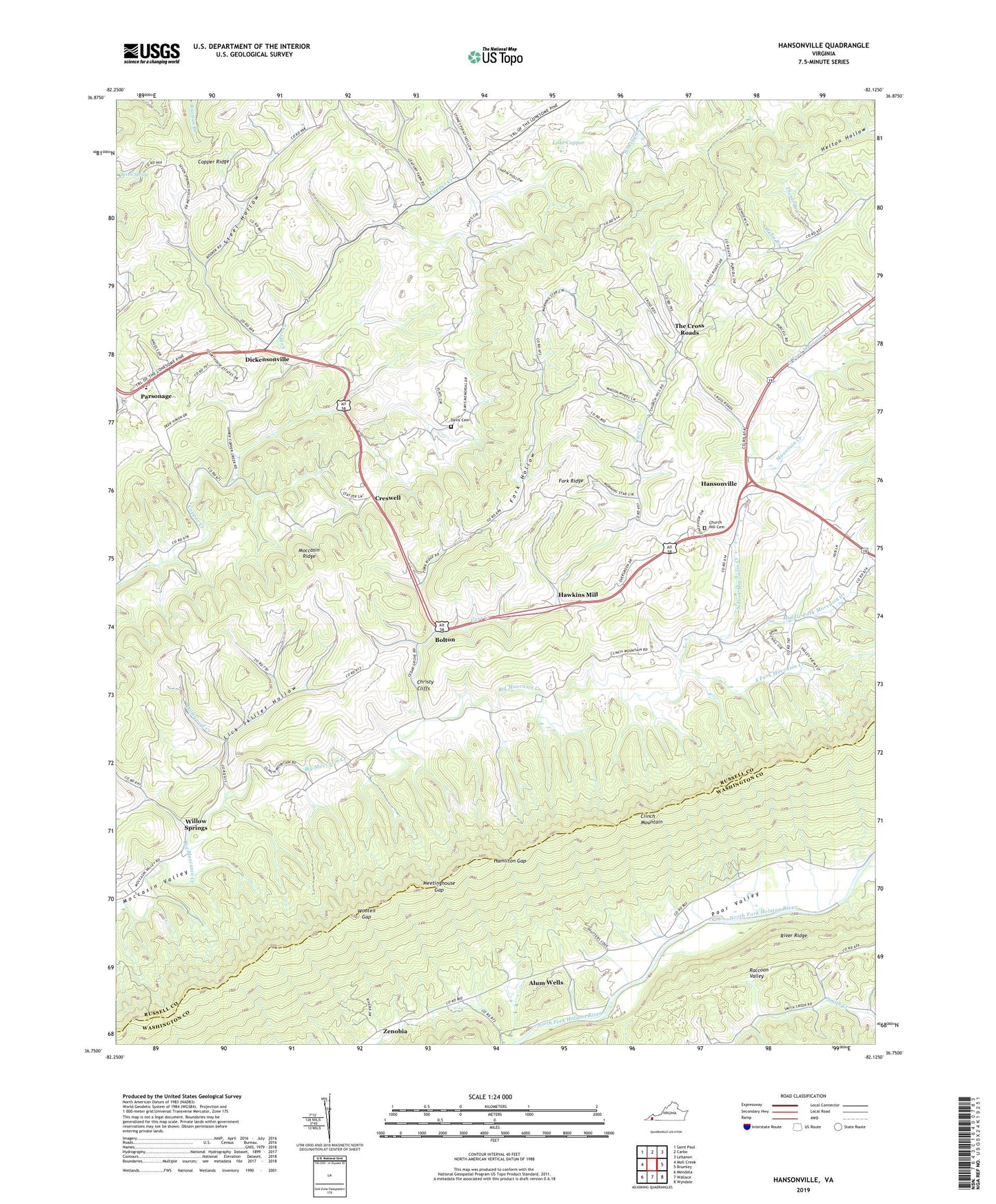
2019 topographic map quadrangle Hansonville in the state of Virginia. Scale: 1:24000. Based on the newly updated USGS 7.5' US Topo map series, this map is in the following counties: Russell, Washington. The map contains contour data, water features, and other items you are used to seeing on USGS maps, but also has updated roads and other features. This is the next generation of topographic maps. Printed on high-quality waterproof paper with UV fade-resistant inks.
Quads adjacent to this one:
West: Moll Creek
Northwest: Saint Paul
North: Carbo
Northeast: Lebanon
East: Brumley
Southeast: Wyndale
South: Wallace
Southwest: Mendota
Contains the following named places: Adams Chapel, Alum Wells, Bolton, Buckeye School, Carr Creek, Cedar Grove Church, Christy Cliffs, Church Hill, Church Hill Cemetery, Copper Creek Elementary School, Creswell, Cross Roads School, Davis Cemetery, Dickensonville, Divide Branch, Driftwood Creek, Fork Hollow, Fork Ridge, Hamilton Gap, Hansonville, Hawkins Mill, Lake Copper, Lick Skillet Hollow, Maple Grove Church, McFadden Ford, Meetinghouse Gap, Middle Fork Moccasin Creek, Mountain Creek, North Fork Church, North Fork Moccasin Creek, Oak Grove Elementary School, Parsonage, Poor Valley Church, Raccoon Valley, River Ridge, South Fork Moccasin Creek, Steel Hollow, Stony Point School, Sulphur Springs School, The Cross Roads, The Lonesome Pine Trail, Willow Springs, Wooten Gap, Zenobia