
MyTopo
Howardsville Virginia US Topo Map
Couldn't load pickup availability
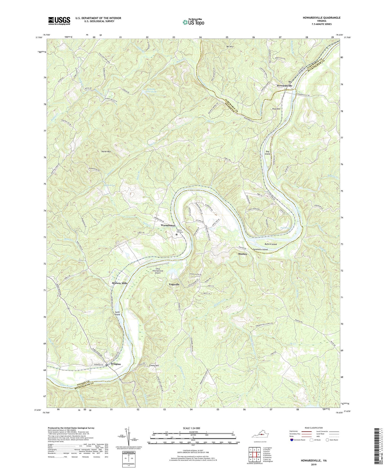
2019 topographic map quadrangle Howardsville in the state of Virginia. Scale: 1:24000. Based on the newly updated USGS 7.5' US Topo map series, this map is in the following counties: Buckingham, Nelson, Albemarle. The map contains contour data, water features, and other items you are used to seeing on USGS maps, but also has updated roads and other features. This is the next generation of topographic maps. Printed on high-quality waterproof paper with UV fade-resistant inks.
Quads adjacent to this one:
West: Shipman
Northwest: Lovingston
North: Schuyler
Northeast: Esmont
East: Glenmore
Southeast: Buckingham
South: Saint Joy
Southwest: Gladstone
Contains the following named places: Ariel Church, Avon Hill, Ballowe Creek, Beaver Creek, Bishop Creek, Branch Creek, Buffalo Creek, Buford Island, Bugley Spring, Cedar Branch, Creasy Creek, Creasy Hill, Dog Island, Fish Pond, Glade Creek, Grace Church, Grays Corner, Greasy Creek, Haw Branch, Horse Mountain, Howardsville, Howardsville Methodist Church, Howardsville Post Office, Ivy Creek, James River State Wildlife Management Area, Jerusalem Church, Kidd Creek, Liberty Hall Cemetery, Lick Creek, Little Sycamore Creek, Lotus International Airport, Manteo, Mayo Creek, Midway Mills, Monticola, Ramsay Knox Dam, Ramsay Knox Pond, Rockfish River, Rockhouse Branch, Ryan Creek, Slater Branch, Stock Branch, Swan Creek, Swift Island, Sycamore Creek, Sycamore Island, Warminster, Warminster Church, Wingina, Wingina Post Office, Wood Farm Airport, Woodland Church, Yogaville, Yogaville Census Designated Place, ZIP Code: 24562


