MyTopo
Lovingston Virginia US Topo Map
Couldn't load pickup availability
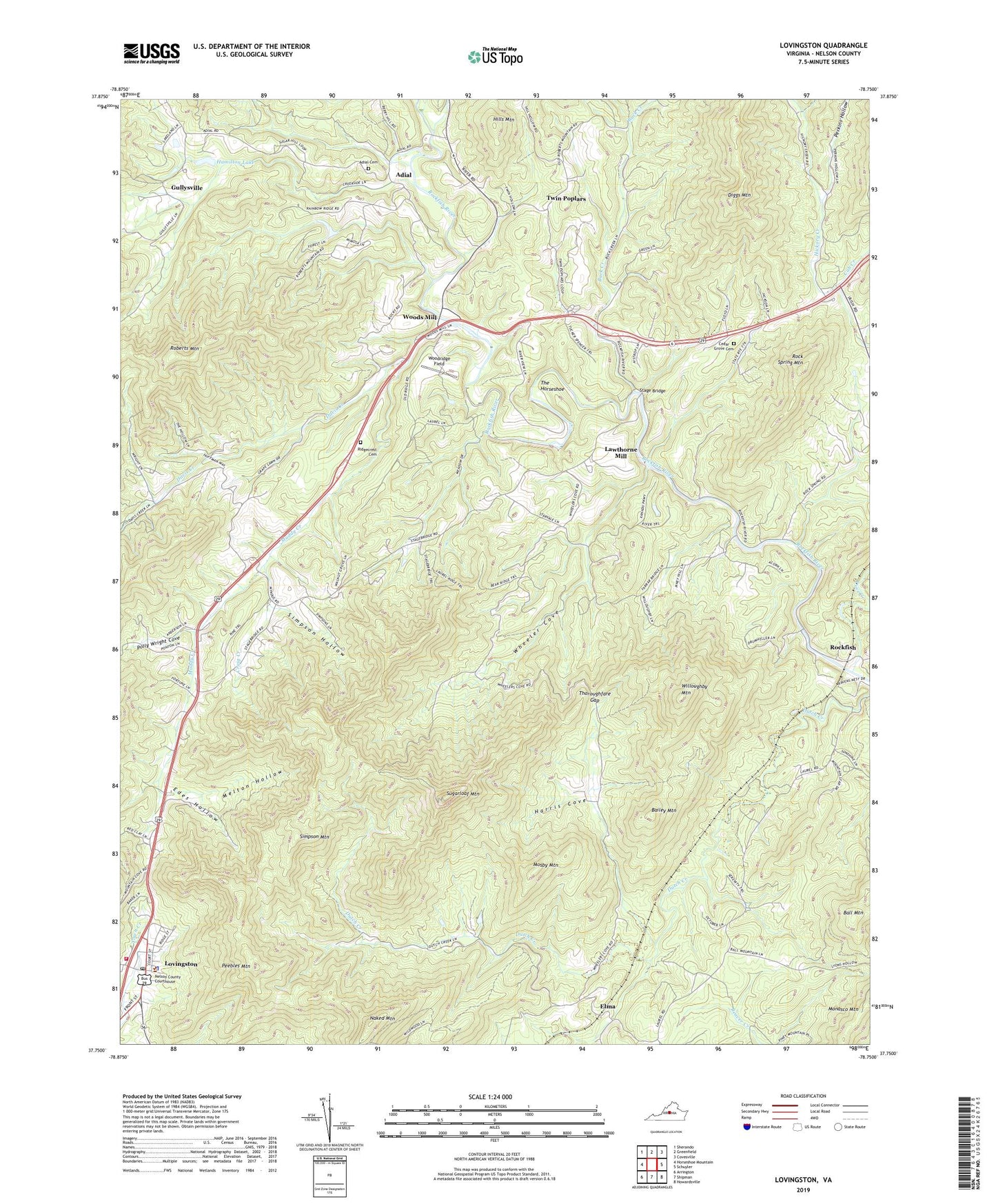
2022 topographic map quadrangle Lovingston in the state of Virginia. Scale: 1:24000. Based on the newly updated USGS 7.5' US Topo map series, this map is in the following counties: Nelson. The map contains contour data, water features, and other items you are used to seeing on USGS maps, but also has updated roads and other features. This is the next generation of topographic maps. Printed on high-quality waterproof paper with UV fade-resistant inks.
Quads adjacent to this one:
West: Horseshoe Mountain
Northwest: Sherando
North: Greenfield
Northeast: Covesville
East: Schuyler
Southeast: Howardsville
South: Shipman
Southwest: Arrington
This map covers the same area as the classic USGS quad with code o37078g7.
Contains the following named places: Adial, Adial Cemetery, Adial Church, Bailey Mountain, Ball Mountain, Bernard Hamilton Dam, Buck Creek, Cedar Grove Cemetery, Cedar Grove Church, Cedar Grove School, Central District, Cove Creek, Craig Creek, Cub Creek, Davis Creek, Davis Creek School, Diggs Mountain, Dutch Creek School, East District, Ebenezer Church, Edes Hollow, Elma, Elmington Church, Gullysville, Hamilton Lake, Harris Cove, Hills Mountain, Lawthorne Mill, Lovingston, Lovingston Census Designated Place, Lovingston Post Office, Lovingston Volunteer Fire Department, Melton Hollow, Mosby Mountain, Mount Zion Church, Muddy Creek, Myndus, Naked Mountain, Nelson County Courthouse, Nelson County Sheriff Office, Oak Hill Church, Old Myndus, Peebles Mountain, Perkins Hollow, Polly Wright Cove, Poplar School, Ridgecrest Baptist Church, Ridgecrest Cemetery, Roberts Mountain, Rock Spring Mountain, Rockfish, Schuyler District, Simpson Hollow, Simpson Mountain, Stage Bridge, Sugarloaf Mountain, The Horseshoe, Thoroughfare Gap, Twin Poplars, Union Springs School, Walnut Grove Church, Wheeler Cove, Willoughby Mountain, Woodridge Field, Woods Mill, ZIP Code: 22938