MyTopo
King And Queen Court House Virginia US Topo Map
Couldn't load pickup availability
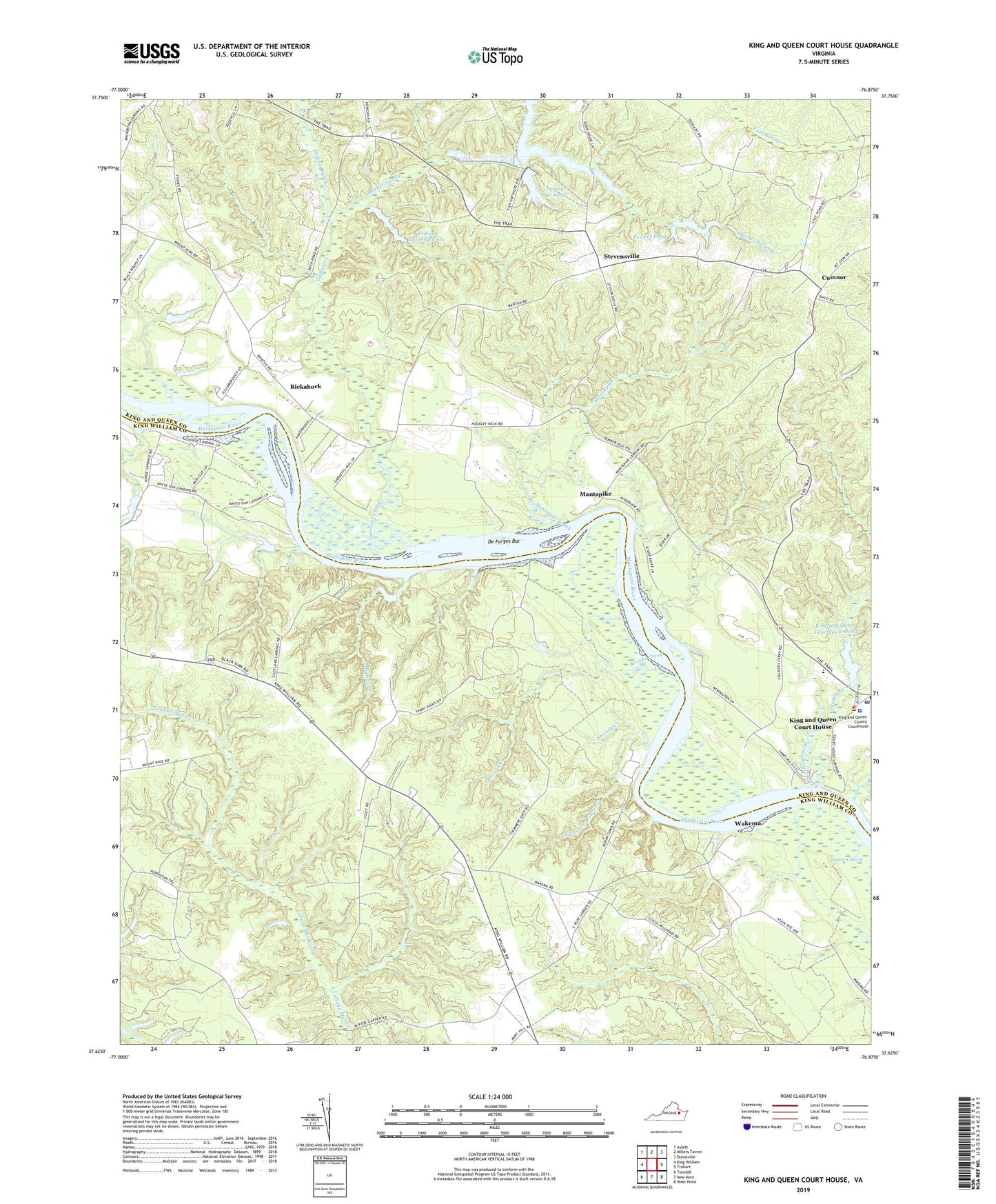
2022 topographic map quadrangle King And Queen Court House in the state of Virginia. Scale: 1:24000. Based on the newly updated USGS 7.5' US Topo map series, this map is in the following counties: King and Queen, King William. The map contains contour data, water features, and other items you are used to seeing on USGS maps, but also has updated roads and other features. This is the next generation of topographic maps. Printed on high-quality waterproof paper with UV fade-resistant inks.
Quads adjacent to this one:
West: King William
Northwest: Aylett
North: Millers Tavern
Northeast: Dunnsville
East: Truhart
Southeast: West Point
South: New Kent
Southwest: Tunstall
This map covers the same area as the classic USGS quad with code o37076f8.
Contains the following named places: Brooks Creek, Central High School, Colosse Church, Courthouse Creek, Courthouse Landing, Cumnor, Dahlgrens Corner, De Farges Bar, Dickeys Swamp, Duck Pond, Frog Hollow Farm Airport, Frog Hollow Sod Farm, Garnetts Creek, Garretts Dam, Gleason Marsh, Hillsboro, Horse Landing, Ice House Dam, Indian Mound Ponds, Indian Mound Ponds Dam, Indian Town Swamp, King and Queen County, King and Queen County Emergency Services Coordinator, King and Queen County Sheriff's Office, King and Queen Court House, King and Queen Court House Census Designated Place, King and Queen Court House Post Office, King and Queen Courthouse Dam, King and Queen Courthouse Pond, Log Landing, Lower King and Queen Volunteer Fire Department, Madison Creek, Mantapike, Mantapike Creek, Mantapike Landing, Mantua Ferry, Market Swamp, Mattaponi Church, Mattaponi Indian Museum, Mattaponi Reservation, Mitchell Hill Creek, Powers Dam, Powers Pond, Rickahock, Rose Garden, Sandy Point, Scotland Landing, Shanty Creek, Spring Branch Pond, Stevensville, Stevensville Dam, Stevensville Pond, Trinity Church, Wakema, Walker Coleman Dam, Walker Coleman Pond, Wayland Church, White Oak Landing, Woodland Creek, Zion Church, ZIP Code: 23161