MyTopo
Burgess Virginia US Topo Map
Couldn't load pickup availability
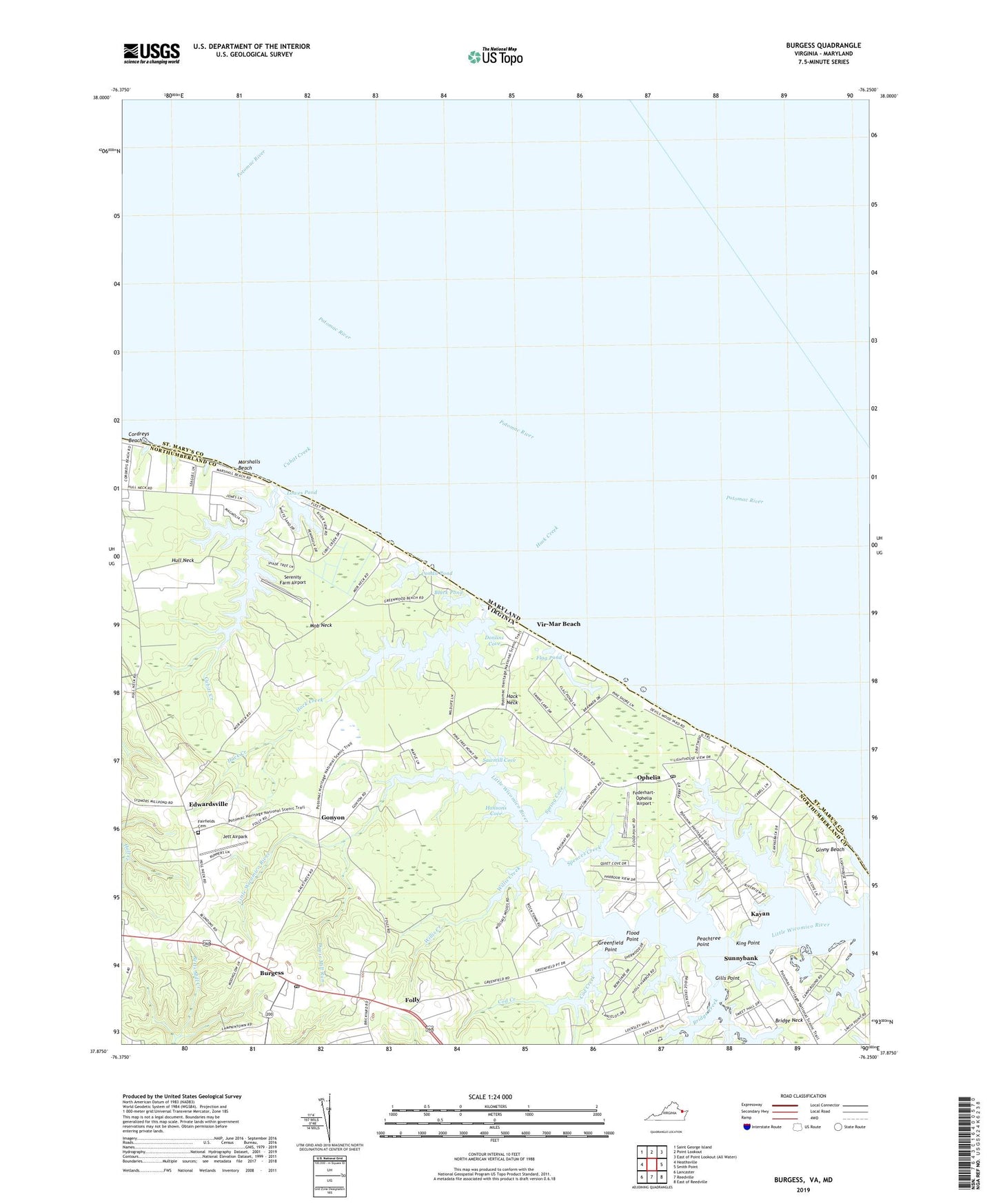
2022 topographic map quadrangle Burgess in the states of Virginia, Maryland. Scale: 1:24000. Based on the newly updated USGS 7.5' US Topo map series, this map is in the following counties: Northumberland, St. Mary's. The map contains contour data, water features, and other items you are used to seeing on USGS maps, but also has updated roads and other features. This is the next generation of topographic maps. Printed on high-quality waterproof paper with UV fade-resistant inks.
Quads adjacent to this one:
West: Heathsville
Northwest: Saint George Island
North: Point Lookout
East: Smith Point
Southeast: East of Reedville
South: Reedville
Southwest: Lancaster
This map covers the same area as the classic USGS quad with code o37076h3.
Contains the following named places: Afton Church, Back Creek, Black Pond, Blundon Corner, Bridge Creek, Bridge Neck, Bridgemans Back Creek, Burgess, Burgess Post Office, Cod Creek, Condit Pond, Cordreys Beach, Cubitt Creek, Davis Mill, Davis Mill Run, Davis Millpond, Donlins Cove, Edwardsville, Edwardsville School, Ellyson Creek, Fairfields Cemetery, Fairfields Church, Fairfields School, Federhart-Ophelia Airport, Flag Pond, Flood Point, Folly, Galilee Church, Gills Point, Ginny Beach, Gonyon, Grays School, Greenfield Point, Hack Creek, Hack Neck, Hack Neck School, Hacks Neck Landing, Hansons Cove, Horse Pond, Hull Neck, Hygeia School, Jett Airpark, Jetts Store, Kayan, King Point, Little Wicomico Landing, Lowes Pond, Marshalls Beach, Mob Neck, Northumberland Volunteer Rescue Squad Station 2, Ophelia, Ophelia Post Office, Peachtree Point, Potomac River, Sawmill Cove, Serenity Farm Airport, Sharps Creek, Shiloh Church, Sloop Creek, Slough Creek, Smith Point Marina, Spences Creek, Spring Cove, Sunnybank, Sunnybank Ferry, Vir-Mar Beach, Walkers Store, Willis Creek, ZIP Code: 22530