MyTopo
Madison Mills Virginia US Topo Map
Couldn't load pickup availability
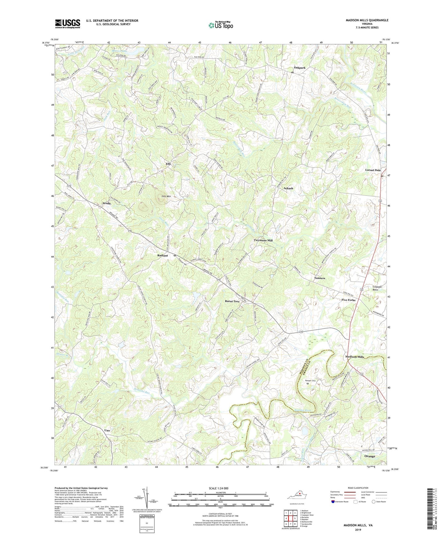
2019 topographic map quadrangle Madison Mills in the state of Virginia. Scale: 1:24000. Based on the newly updated USGS 7.5' US Topo map series, this map is in the following counties: Madison, Orange. The map contains contour data, water features, and other items you are used to seeing on USGS maps, but also has updated roads and other features. This is the next generation of topographic maps. Printed on high-quality waterproof paper with UV fade-resistant inks.
Quads adjacent to this one:
West: Rochelle
Northwest: Madison
North: Brightwood
Northeast: Culpeper West
East: Rapidan
Southeast: Orange
South: Gordonsville
Southwest: Barboursville
Contains the following named places: Achash, Aroda, Beautiful Run, Beautiful Run Number 10 Dam, Beautiful Run Number 11 Dam, Beautiful Run Number Five Dam, Beautiful Run Number Four Dam, Beautiful Run Number Seven Dam, Beautiful Run Number Six Dam, Burnt Tree, Elly, Five Forks, Good Hope Baptist Church, Grymes Memorial School, Kemper Cemetery, Laurel Run, Locust Dale, Locust Dale District, Locust Dale Post Office, Locust Grove Baptist Church, Lost Mountain, Madison Mills, Main Uno Baptist Church, Malvern Dam, Malvern Lake, Mount Pisgah Church, Mount Zion Church, Oak Grove Church, Oak Grove Mennonite Church, Oak Grove Mennonite School, Oakpark, Oakpark Post Office, Poplar Run, Prices Shop, Radiant, Radiant Post Office, Skinner Branch, Tanners, Twymans Mill, Uno, Walker's United Methodist Church, ZIP Codes: 22709, 22730, 22732, 22948, 22989