MyTopo
Gordonsville Virginia US Topo Map
Couldn't load pickup availability
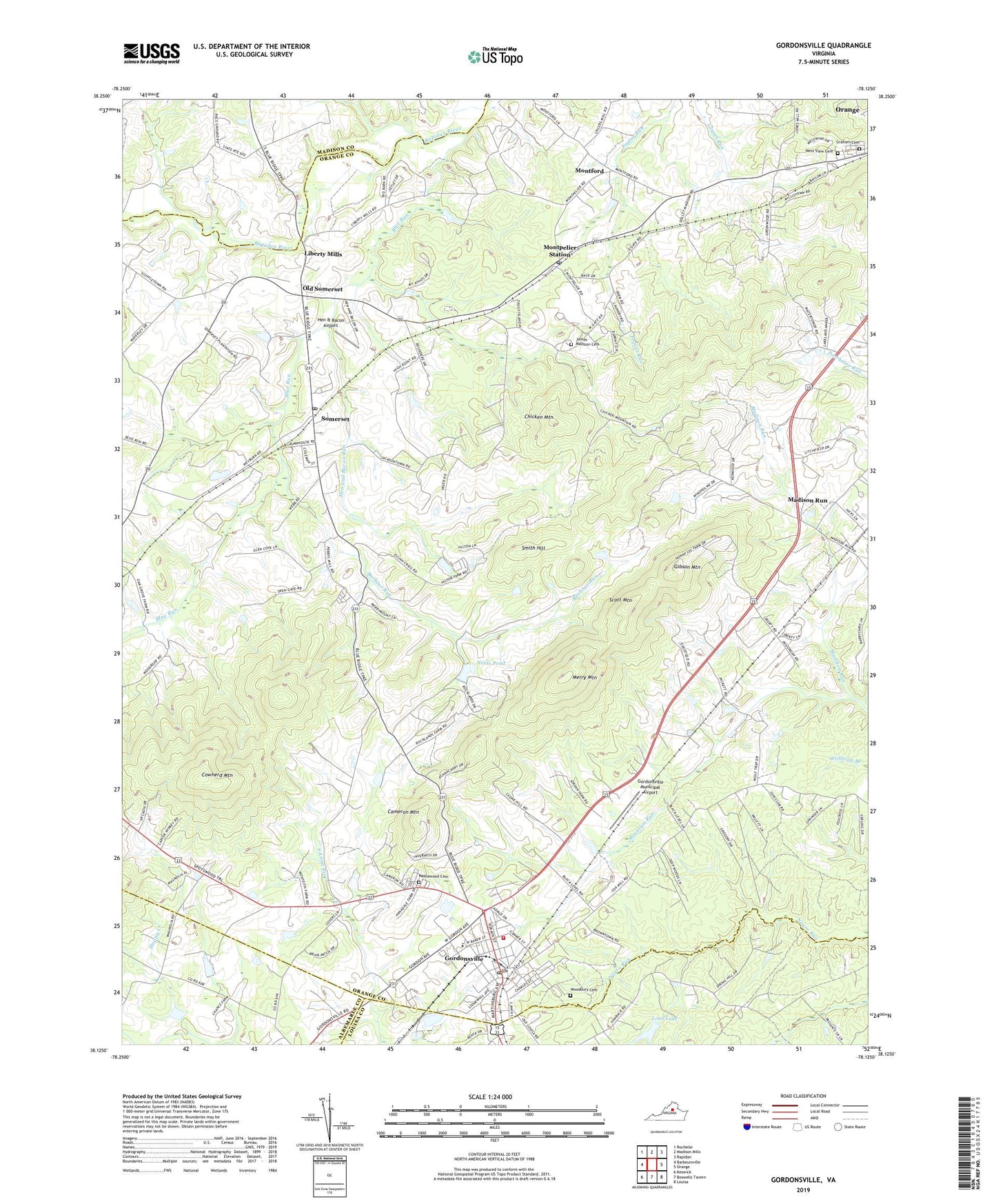
2022 topographic map quadrangle Gordonsville in the state of Virginia. Scale: 1:24000. Based on the newly updated USGS 7.5' US Topo map series, this map is in the following counties: Orange, Louisa, Madison, Albemarle. The map contains contour data, water features, and other items you are used to seeing on USGS maps, but also has updated roads and other features. This is the next generation of topographic maps. Printed on high-quality waterproof paper with UV fade-resistant inks.
Quads adjacent to this one:
West: Barboursville
Northwest: Rochelle
North: Madison Mills
Northeast: Rapidan
East: Orange
Southeast: Louisa
South: Boswells Tavern
Southwest: Keswick
This map covers the same area as the classic USGS quad with code o38078b2.
Contains the following named places: Barbour Run, Blue Run, Blue Run Baptist Church, Cameron Mountain, Chicken Mountain, Christ Episcopal Church, Cowherd Mountain, District 1, Dix Memorial Pool, Gibson Mountain, Gordon - Barbour Elementary School, Gordonsville, Gordonsville Baptist Church, Gordonsville Historic District, Gordonsville Municipal Airport, Gordonsville Police Department, Gordonsville Post Office, Gordonsville Volunteer Fire Company 24, Graham Cemetery, Happy Creek Dam, Happy Creek Lake, Hen & Bacon Airport, Hen and Bacon Run, James Madison Cemetery, Liberty Mills, Lous Airport, Lous Lake, Madison Run, Madison-Barbour Rural Historic District, Maplewood Cemetery, Merry Mountain, Mittleman Dam, Montford, Montpelier, Montpelier Station, Montpelier Station Post Office, Neals Dam, Neals Pond, Oak Chapel, Old Gordon Inn Memorial, Old Somerset, Orange County Rescue Squad Gordonsville Garage, Orange County Rescue Squad Station 24, Orange-Gordonsville Community Hospital, Scott Mountain, Smith Hill, Somerset, Somerset Christian Church, Somerset Post Office, Town of Gordonsville, West View Cemetery, Weyburn, Woodbury Cemetery, Zion Church, ZIP Code: 22972


