MyTopo
Rapidan Virginia US Topo Map
Couldn't load pickup availability
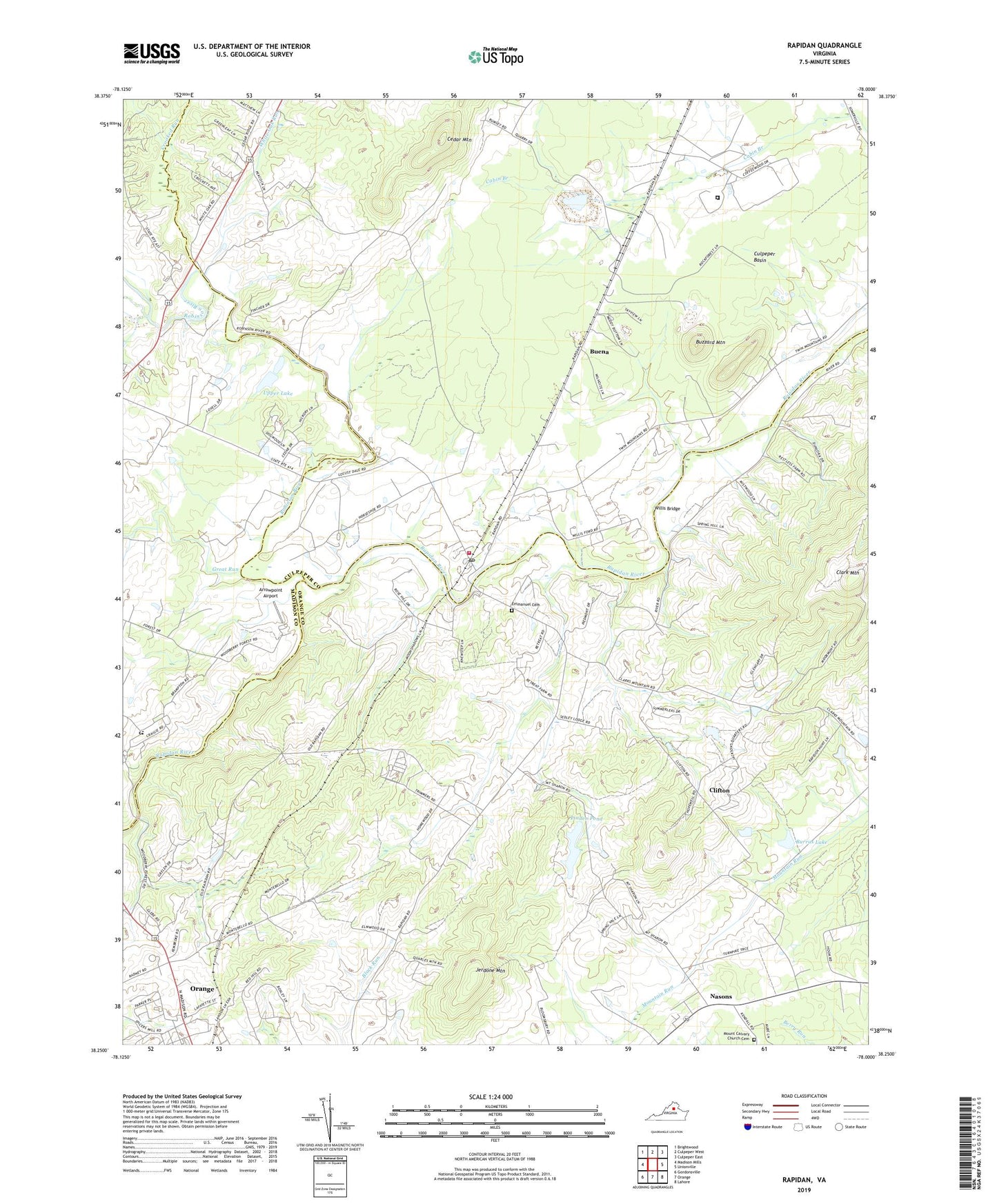
2022 topographic map quadrangle Rapidan in the state of Virginia. Scale: 1:24000. Based on the newly updated USGS 7.5' US Topo map series, this map is in the following counties: Orange, Culpeper, Madison. The map contains contour data, water features, and other items you are used to seeing on USGS maps, but also has updated roads and other features. This is the next generation of topographic maps. Printed on high-quality waterproof paper with UV fade-resistant inks.
Quads adjacent to this one:
West: Madison Mills
Northwest: Brightwood
North: Culpeper West
Northeast: Culpeper East
East: Unionville
Southeast: Lahore
South: Orange
Southwest: Gordonsville
This map covers the same area as the classic USGS quad with code o38078c1.
Contains the following named places: Arrowpoint Airport, Aston Quarry, Beaverdam Run, Buena, Burrus Dam, Burrus Lake, Buzzard Mountain, Cedar Grove Church, Cedar Mountain, Clark Mountain, Clifton, Coffeewood Correctional Center, Crooked Run, Crooked Run Church, District 3, Emmanuel Cemetery, Emmanuel Church, Emmanuel Episcopal Church, Faith Tabernacle Pentecostal Holiness Church, Great Run, Hartland-Hall Dam Number Two, Hopewell Church, Jerdone Mountain, Larmond, Linden Dam, Linden Pond, Mitchell Quarry, Mount Calvary Church, Mount Calvary Church Cemetery, Nasons, Orange Church of the Nazarene, Orange Village Shopping Center, Rapidan, Rapidan Post Office, Rapidan Volunteer Fire and Rescue Department, Rapidian Historic District, Robinson River, Saint Johns Catholic Church, Trimmers Crossing, Upper Lake, Virginia Black Granite Quarry, White Oak Run, White Oak Run Church, Willis Bridge, WJMA-AM (Orange), WJMA-FM (Orange), Woodberry Forest Plantation, Woodberry Forest Post Office, Woodberry Forest School, ZIP Codes: 22729, 22733