MyTopo
Metompkin Inlet Virginia US Topo Map
Couldn't load pickup availability
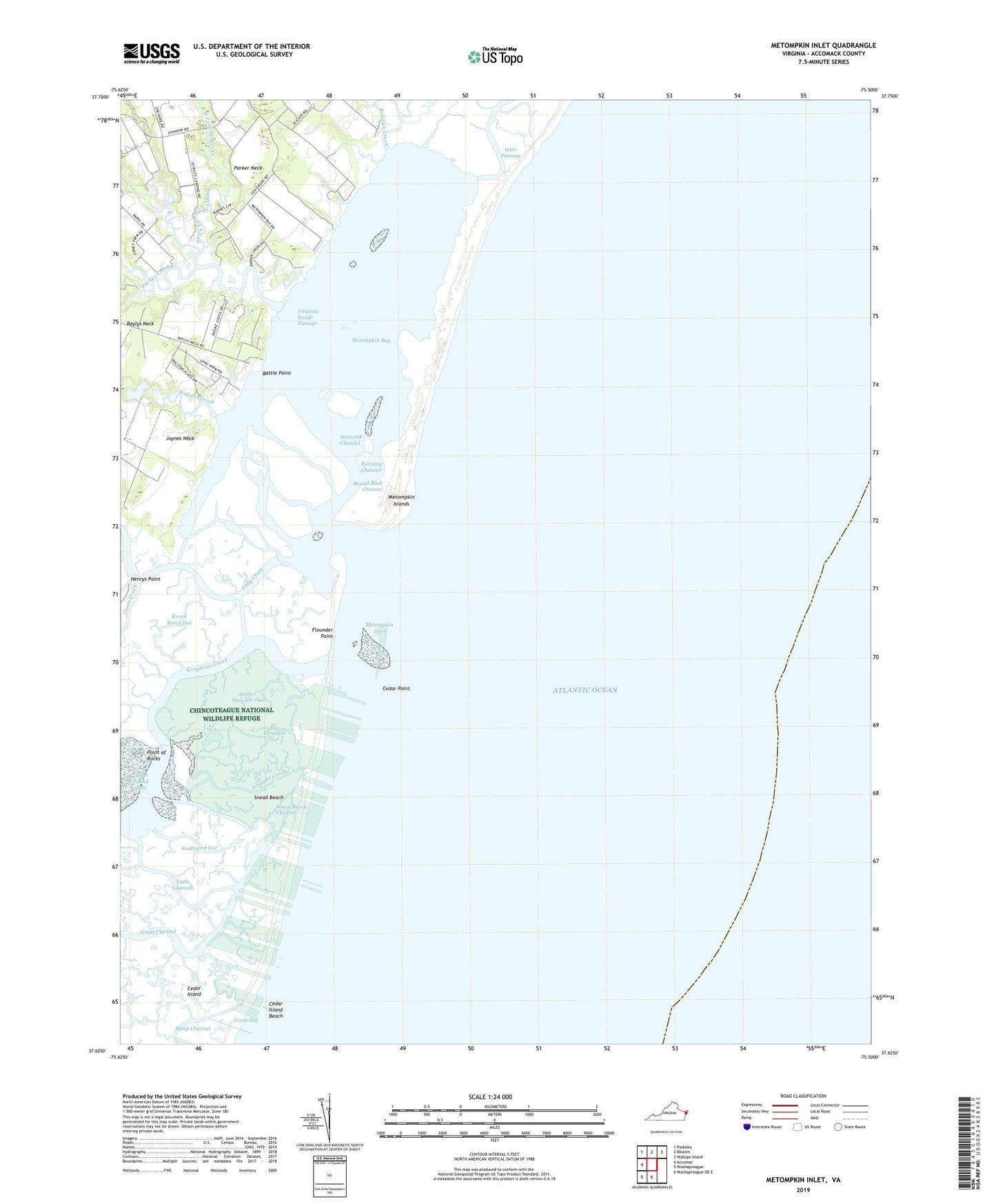
2022 topographic map quadrangle Metompkin Inlet in the state of Virginia. Scale: 1:24000. Based on the newly updated USGS 7.5' US Topo map series, this map is in the following counties: Accomack. The map contains contour data, water features, and other items you are used to seeing on USGS maps, but also has updated roads and other features. This is the next generation of topographic maps. Printed on high-quality waterproof paper with UV fade-resistant inks.
Quads adjacent to this one:
West: Accomac
Northwest: Parksley
North: Bloxom
Northeast: Wallops Island
South: Wachapreague OE E
Southwest: Wachapreague
This map covers the same area as the classic USGS quad with code o37075f5.
Contains the following named places: Battle Point, Baylys Neck, Big Thrasher Gut, Bundick Creek, Cedar Island, Cedar Island Bay, Cedar Island Beach, Cedar Point, Crippen Creek, Deep Creek, Flounder Point, Folly Creek, Great Channel, Great Gut, Henrys Point, Knock Knees Gut, Little Channel, Little Thrasher Gut, Longboat Creek, Metompkin Bay, Metompkin Inlet, North Fork Parker Creek, Parker Creek, Parker Neck, Point of Rocks, Poplar Creek, Round Rock Channel, Running Channel, Sloop Channel, Snead Beach, Snead Beach Channel, Southwest Gut, Straight Creek, Virginia Inside Passage, Walston Creek, Walston Creek Dam, Warwick Channel