MyTopo
Monterey Virginia US Topo Map
Couldn't load pickup availability
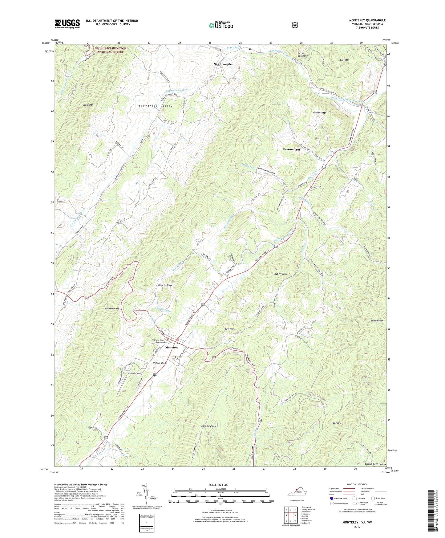
2019 topographic map quadrangle Monterey in the state of Virginia. Scale: 1:24000. Based on the newly updated USGS 7.5' US Topo map series, this map is in the following counties: Highland, Pendleton. The map contains contour data, water features, and other items you are used to seeing on USGS maps, but also has updated roads and other features. This is the next generation of topographic maps. Printed on high-quality waterproof paper with UV fade-resistant inks.
Quads adjacent to this one:
West: Hightown
Northwest: Thornwood
North: Snowy Mountain
Northeast: Moatstown
East: Doe Hill
Southeast: McDowell
South: Monterey SE
Southwest: Mustoe
Contains the following named places: Asbury Church, Barren Rock, Blue Grass Post Office, Blue Grass School, Burners Run, Central Church, Doe Hill, Elk Run, Forks of Waters, Frank Run, Ginseng Mountain, Gulf Mountain, Hannah Field, Highland County Sheriff's Office, Highland County Volunteer Fire Department, Highland County Volunteer Rescue Squad, Highland Elementary School, Highland High School, Hightown Church, Key Run, Lantz Mountain, Laurel Run, Miracle Ridge, Monterey, Monterey Methodist Episcopal Church, Monterey Mountain, Monterey Post Office, New Hampden, Peck Run, Possum Trot, Rich Hills, Seybert Chapel, Seybert Hills, Simmons Run, Strait Creek, Strait Creek School, Thorny Bottom Church, Town of Monterey, Trimble Knob, Union Chapel, West Strait Creek, White Run, Wooden Run