MyTopo
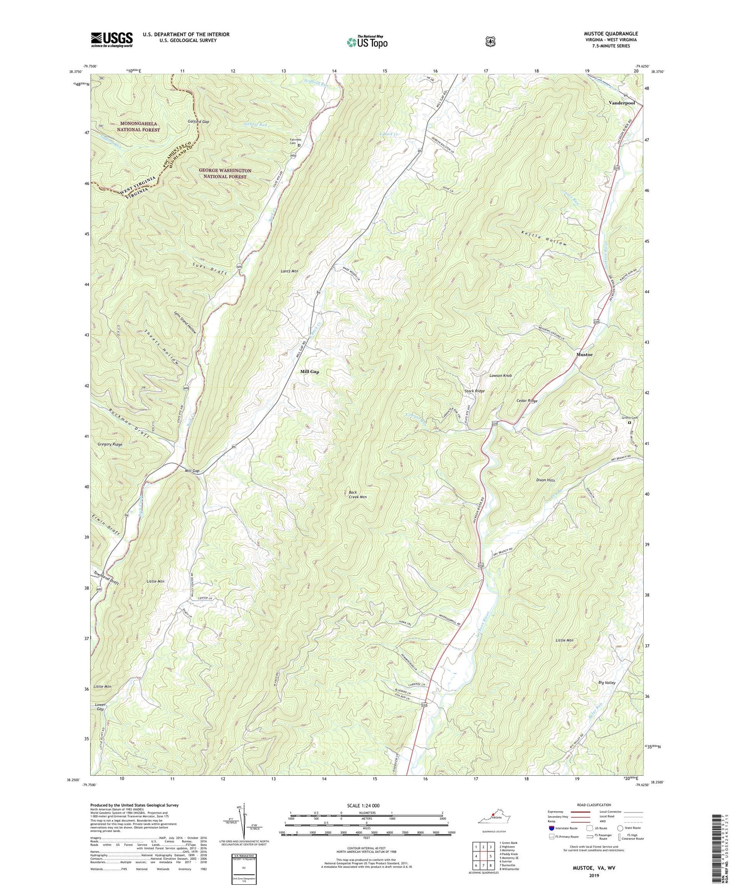
Mustoe Virginia US Topo Map
Couldn't load pickup availability
Also explore the Mustoe Forest Service Topo of this same quad for updated USFS data
2022 topographic map quadrangle Mustoe in the state of Virginia. Scale: 1:24000. Based on the newly updated USGS 7.5' US Topo map series, this map is in the following counties: Highland, Pocahontas. The map contains contour data, water features, and other items you are used to seeing on USGS maps, but also has updated roads and other features. This is the next generation of topographic maps. Printed on high-quality waterproof paper with UV fade-resistant inks.
Quads adjacent to this one:
West: Paddy Knob
Northwest: Green Bank
North: Hightown
Northeast: Monterey
East: Monterey SE
Southeast: Williamsville
South: Burnsville
Southwest: Sunrise
Contains the following named places: Back Creek Mountain, Beulah Presbyterian Church, Big Valley, Buckeye, Cedar Ridge, Dixon Hills, Dry Branch, Dry Run, East Back Creek, Eowyns Run, Erwin Draft, Fairview Cemetery, Galford Gap, Green Hill Church, Green Hill School, Griffin Cemetery, Jones Run, Kettle Hollow, Lawson Knob, Little Mountain, Lynn Stand Hollow, Mill Gap, Mustoe, Naples, Plum Grove School, River View School, Riverview Church, Ruckman Draft, Scaffold Run, Sheets Hollow, Siebert Run, Stark Ridge, Sues Draft, Townsend Draft, Valley Center, Vanderpool, Victory Chapel, Vinegar Run, Warwick Run, Wesley Chapel, Woods-Terry School