
MyTopo
New Castle Virginia US Topo Map
Couldn't load pickup availability
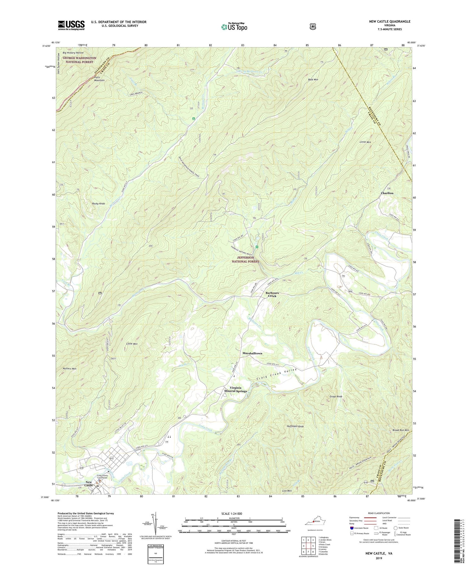
2019 topographic map quadrangle New Castle in the state of Virginia. Scale: 1:24000. Based on the newly updated USGS 7.5' US Topo map series, this map is in the following counties: Craig, Botetourt, Alleghany. The map contains contour data, water features, and other items you are used to seeing on USGS maps, but also has updated roads and other features. This is the next generation of topographic maps. Printed on high-quality waterproof paper with UV fade-resistant inks.
Quads adjacent to this one:
West: Potts Creek
Northwest: Alleghany
North: Jordan Mines
Northeast: Strom
East: Oriskany
Southeast: Daleville
South: Catawba
Southwest: Looney
Contains the following named places: Bald Mountain, Barbours Creek, Barbours Creek School, Barbours Creek Wilderness, Camp Easter Seal, Charlton, Cold Spring Branch, Cove Branch, Craig City District, Craig County Middle - High School, Craig County Rescue Squad and Emergency Medical Services, Craig County Sheriff's Office, Craig Creek Valley, Craigs Creek, Cross Roads Church, Dry Branch, Fenwick Mine, Fenwick Mines Campground, Fenwick Nature Trail, Given, Grays Knob, Hebron Church, Huffmans Knob, Johns Creek, Lipes Branch, Little Mountain, Managers Depot, Marshalltown, McCleary Elementary School, Middle Mountain, Mill Creek, New Castle, New Castle Historic District, New Castle Post Office, New Castle Work Center, Pine Top, Ripleys Mill, Rocky Knob, Rolands Run Branch, South Prong Barbours Creek, The Pines Campground, The Pines Horse Corral, Town of New Castle, Virginia Mineral Springs, Virginia Mineral Springs Post Office, Wilderness Outdoor Opportunity Discovery School, ZIP Code: 24130


