MyTopo
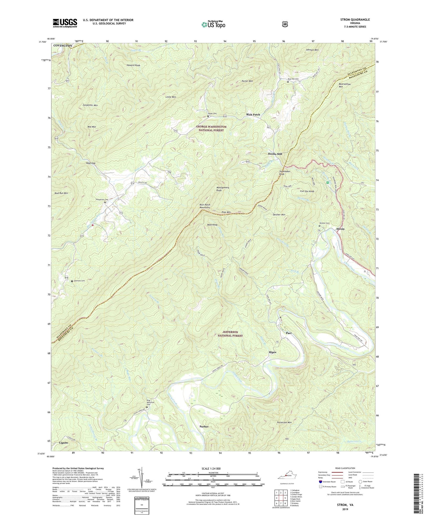
Strom Virginia US Topo Map
Couldn't load pickup availability
Also explore the Strom Forest Service Topo of this same quad for updated USFS data
2022 topographic map quadrangle Strom in the state of Virginia. Scale: 1:24000. Based on the newly updated USGS 7.5' US Topo map series, this map is in the following counties: Botetourt, Alleghany, Covington (city). The map contains contour data, water features, and other items you are used to seeing on USGS maps, but also has updated roads and other features. This is the next generation of topographic maps. Printed on high-quality waterproof paper with UV fade-resistant inks.
Quads adjacent to this one:
West: Jordan Mines
Northwest: Callaghan
North: Covington
Northeast: Clifton Forge
East: Eagle Rock
Southeast: Salisbury
South: Oriskany
Southwest: New Castle
This map covers the same area as the classic USGS quad with code o37079f8.
Contains the following named places: Bald Knob, Bearwallow Mountain, Biggs Run, Boiling Springs Volunteer Fire Department and Rescue Squad Station 2, Carpenter Mountain, Cedar Grove Church, Cedar Grove School, Crawford Branch, Deisher Branch, Deisher Cemetery, Deisher Mountain, Deisher-Hook School, Finley Branch, Furnace Branch, Grace Furnace, Hays Gap, Hipes, Hipes Branch, Hollow Ford, Hook School, Hooks Cemetery, Hooks Mill, Horton, Howard Knob, Humphries Cemetery, Iron Ore Knob, Johnson Mountain, King Memorial Cemetery, Lemons Branch, Lignite, Little Mountain, Longdale Church, Middle Mountain, Montgomery Knob, Mountain Valley Church, Mountain Valley School, Mud Run Mountain, Parr, Peanut Mine, Pine Mountain, Porter Mountain, Rich Patch, Rich Patch Mountains, Rich Patch Quarry, Ritchpatch Mine, Roaring Run, Roaring Run Furnace, Roaring Run Furnace Recreation Site, Rose Hill Cemetery, Shoemaker Knob, Silent Dell, Simmons Cemetery, Slash School, Stony Run, Strom, Surber, Swanson Branch, Wolf Branch