MyTopo
Pilot Virginia US Topo Map
Couldn't load pickup availability
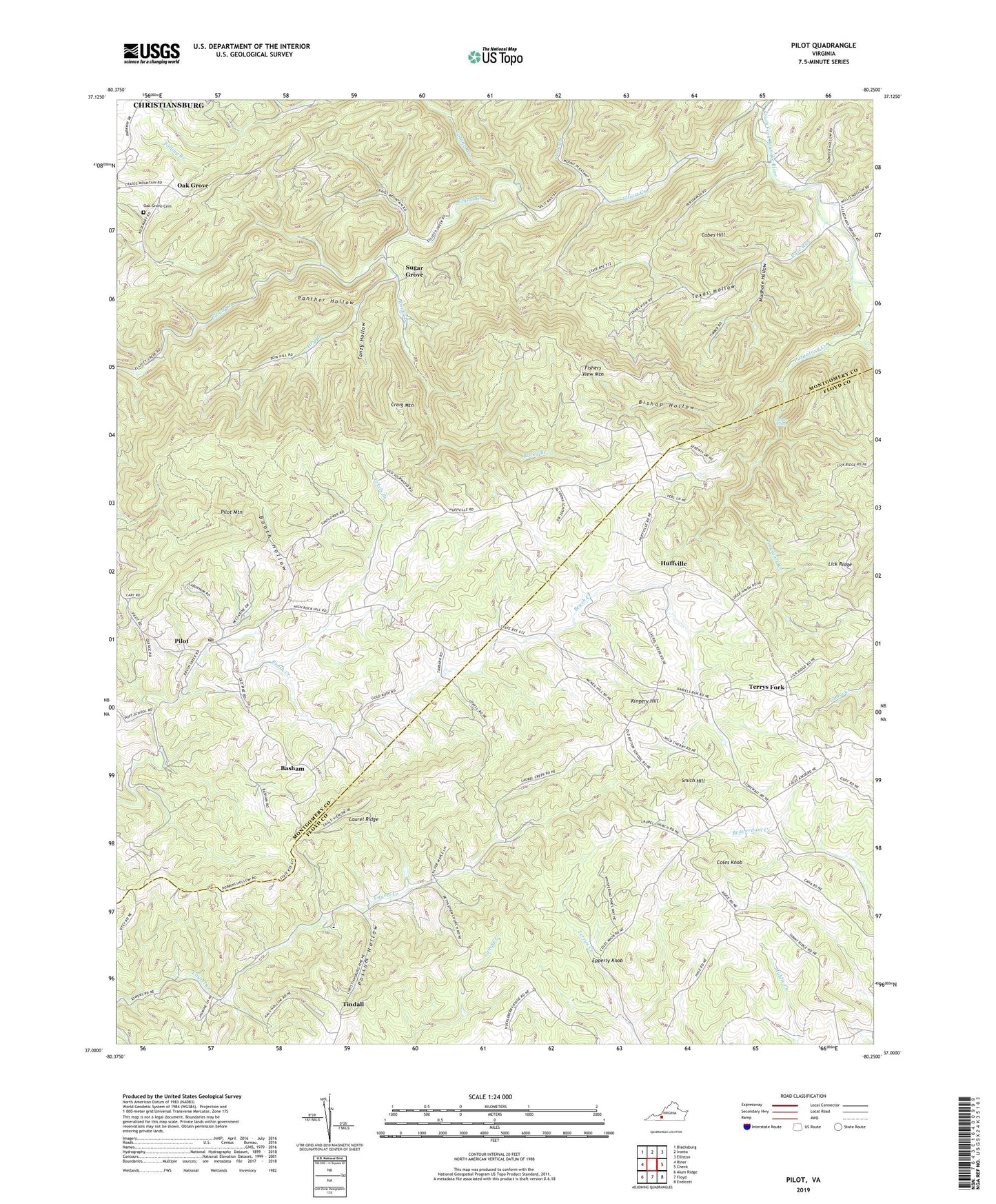
2019 topographic map quadrangle Pilot in the state of Virginia. Scale: 1:24000. Based on the newly updated USGS 7.5' US Topo map series, this map is in the following counties: Montgomery, Floyd. The map contains contour data, water features, and other items you are used to seeing on USGS maps, but also has updated roads and other features. This is the next generation of topographic maps. Printed on high-quality waterproof paper with UV fade-resistant inks.
Quads adjacent to this one:
West: Riner
Northwest: Blacksburg
North: Ironto
Northeast: Elliston
East: Check
Southeast: Endicott
South: Floyd
Southwest: Alum Ridge
Contains the following named places: Alleghany Church, Alleghany Spring School, Altoona School, Arsenic Mine, Basham, Bethlehem Church, Bishop Hollow, Booth Hollow, Cabes Hill, Camp Alta Mons, Chapel Hill School, Coles Knob, Cooks Branch, Craig Mountain, Crockett Spring, Dry Branch, Eckels Branch, Epperly Knob, Falling Branch, Fishers View Mountain, Fishers View School, Havens Chapel, High Rock Church, High Rock School, Huffville, Kingery Hill, Laurel Creek Church, Laurel Ridge, Lick Ridge, Lick Ridge School, Middle Ridge School, Mountain View Church, Mudhole Hollow, Oak Grove, Oak Grove Cemetery, Oak Grove School, Panther Hollow, Pilot, Pilot Mountain, Pilot Post Office, Pleasant View School, Possum Hollow, Possum Hollow School, Purgatory Creek, Rifton School, Rocky Branch, Rose Run, Saint Mathews Church, Smith Hill, Sowders Chapel Baptist Church, Styles Falls, Sugar Grove, Tanzy Hollow, Tekoa School, Terrys Fork, Texas Hollow, Texas Hollow Church, Texas Hollow School, Tindall, Vaughns Chapel, Windy Hill Church, ZIP Code: 24138