MyTopo
Purdy Virginia US Topo Map
Couldn't load pickup availability
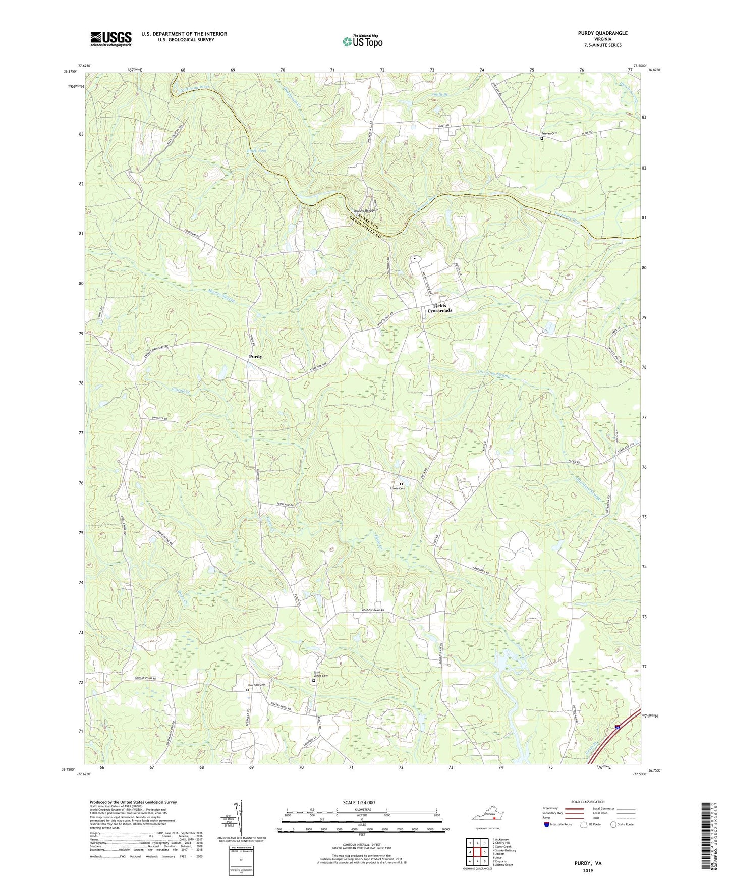
2019 topographic map quadrangle Purdy in the state of Virginia. Scale: 1:24000. Based on the newly updated USGS 7.5' US Topo map series, this map is in the following counties: Greensville, Sussex. The map contains contour data, water features, and other items you are used to seeing on USGS maps, but also has updated roads and other features. This is the next generation of topographic maps. Printed on high-quality waterproof paper with UV fade-resistant inks.
Quads adjacent to this one:
West: Smoky Ordinary
Northwest: McKenney
North: Cherry Hill
Northeast: Stony Creek
East: Jarratt
Southeast: Adams Grove
South: Emporia
Southwest: Ante
Contains the following named places: Aberdour Presbyterian Church, Barnes and Parsons Store, Black Pool, Cattail Creek, Cowie Cemetery, Cowie Corner, Creek View Farm, District 4, Doodlum Hunt Club, Double Bridge, Elm Grove Farm, Fields Crossroads, Grace Church, Grasspond School, Gwaltney School, Hardwood Creek, Harrison Cemetery, Jackson-Field Episcopal Home, Lazottes Ford, Little Shiloh Church, Little Shiloh School, Mayo School, Millview Farm, Moores Swamp, Mount Pleasant Church, Nottoway District, Oak Lawn, Orion Vue Farm, Purdy, Purdy Baptist Church, Purdy School, Reedy Branch, Rivers Edge, Robertson School, Saint Johns Cemetery, Saint Johns Church, Sharon Church, Squires Hill Farm, Trisvan Cemetery, Walnut Grove, Waybay, Wes-Vue Farm, Willow Oaks