MyTopo
Riner Virginia US Topo Map
Couldn't load pickup availability
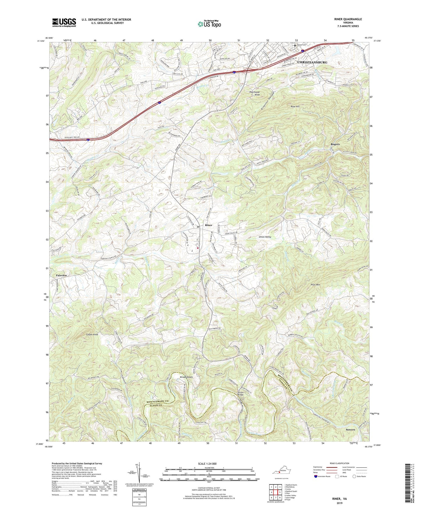
2019 topographic map quadrangle Riner in the state of Virginia. Scale: 1:24000. Based on the newly updated USGS 7.5' US Topo map series, this map is in the following counties: Montgomery, Floyd. The map contains contour data, water features, and other items you are used to seeing on USGS maps, but also has updated roads and other features. This is the next generation of topographic maps. Printed on high-quality waterproof paper with UV fade-resistant inks.
Quads adjacent to this one:
West: Radford South
Northwest: Radford North
North: Blacksburg
Northeast: Ironto
East: Pilot
Southeast: Floyd
South: Alum Ridge
Southwest: Indian Valley
Contains the following named places: Altizer Bridge, Atkinson Acres, Auburn Elementary School, Auburn High School, Auburn Middle School, Bennetts Dam, Bethany Church, Broad Shoals, Broad Shoals Ford, Brush Creek, Buck Shoals Branch, Calfee Knob, Camp Carysbrook, Canterbury, Chestnut Ridge School, Childress School, Christiansburg Middle School, District D-01, Easter Creek, Edgemont Church, Edgewood, Fairview, Fairview Church, Franklin Park, Grace Church, Highland Park, Highview Terrace, Huff Acres, Kingston Court, Kingston Hollow, Laurel Creek, Laurel Fork School, Little Camp Creek, Lynwood Terrace, Mockingbird Hill, Mount Elbert Church, Mount Jackson Church, Nixon School, Patrick County Sheriffs Office, Poff School, Poorhouse Knob, Poplar Branch, Riner, Riner Census Designated Place, Riner Historic District, Riner Post Office, Riner Volunteer Fire Department, Riner Volunteer Rescue Squad, Rogers, Rose Hill, Rosehill Addition, Scaggs Ford, Shadeland Addition, Sidney Church, Smith Creek, South Hill Park, Sowers, Sunset Cemetery, Town and Country Estates, Union Valley, Union Valley Church, Union Valley School, Walnut Grove, ZIP Code: 24149