MyTopo
Ruther Glen Virginia US Topo Map
Couldn't load pickup availability
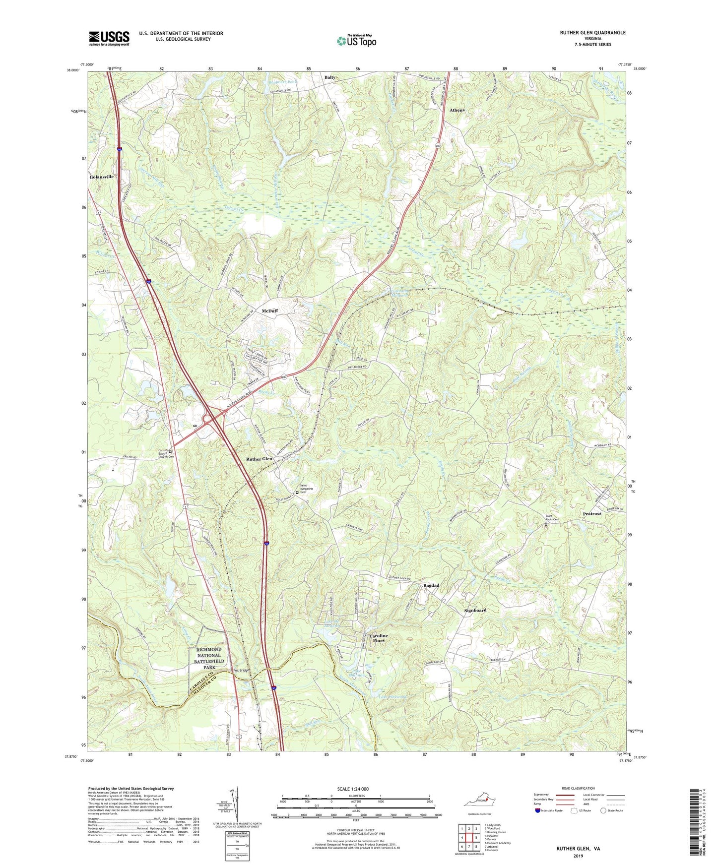
2019 topographic map quadrangle Ruther Glen in the state of Virginia. Scale: 1:24000. Based on the newly updated USGS 7.5' US Topo map series, this map is in the following counties: Caroline, Hanover. The map contains contour data, water features, and other items you are used to seeing on USGS maps, but also has updated roads and other features. This is the next generation of topographic maps. Printed on high-quality waterproof paper with UV fade-resistant inks.
Quads adjacent to this one:
West: Hewlett
Northwest: Ladysmith
North: Woodford
Northeast: Bowling Green
East: Penola
Southeast: Hanover
South: Ashland
Southwest: Hanover Academy
Contains the following named places: Athens, Bagdad, Balty, Boulware Pond, Boulwares Millpond Dam, Bull Run, Burruss Corner, Carmel Baptist Church Cemetery, Carmel Church, Carmel Church Quarry, Carmel Methodist Church, Caroline Pines, Caroline Pines Dam, Cassra School, Chandler Crossing, Coburn Dam, Colemans Mill Crossing, Colemans Millpond, DeJarnette Mill Run, Fox Bridge, Hackett Creek, Jericho Church, Lake De Jarnette, Lake De Jarnette Dam, Lake Pinewood, Lake Pinewood Dam, Lake Shannon, Long Creek, Mattaponi District, McBryant Corner, McDuff, Mill Run, Millpond Swamp, Moncure Corner, Mount Oni Church, Patersons Corner, Peatross, R Collins Dam, Rafe Swamp, Reedy Church, Reedy Church District, Reedy Swamp, Ruther Glen, Ruther Glen Church, Ruther Glen Post Office, Ruther Glen School, Saddle Swamp, Saint Margarets Cemetery, Saint Margarets Church, Saint Pauls Church, Saint Paul's Untited Methodist Church Cemetery, Second Baptist Church, Signboard, Stevens Mill Run, Swans Corner, The Carmel School, ZIP Code: 22546