MyTopo
Woodford Virginia US Topo Map
Couldn't load pickup availability
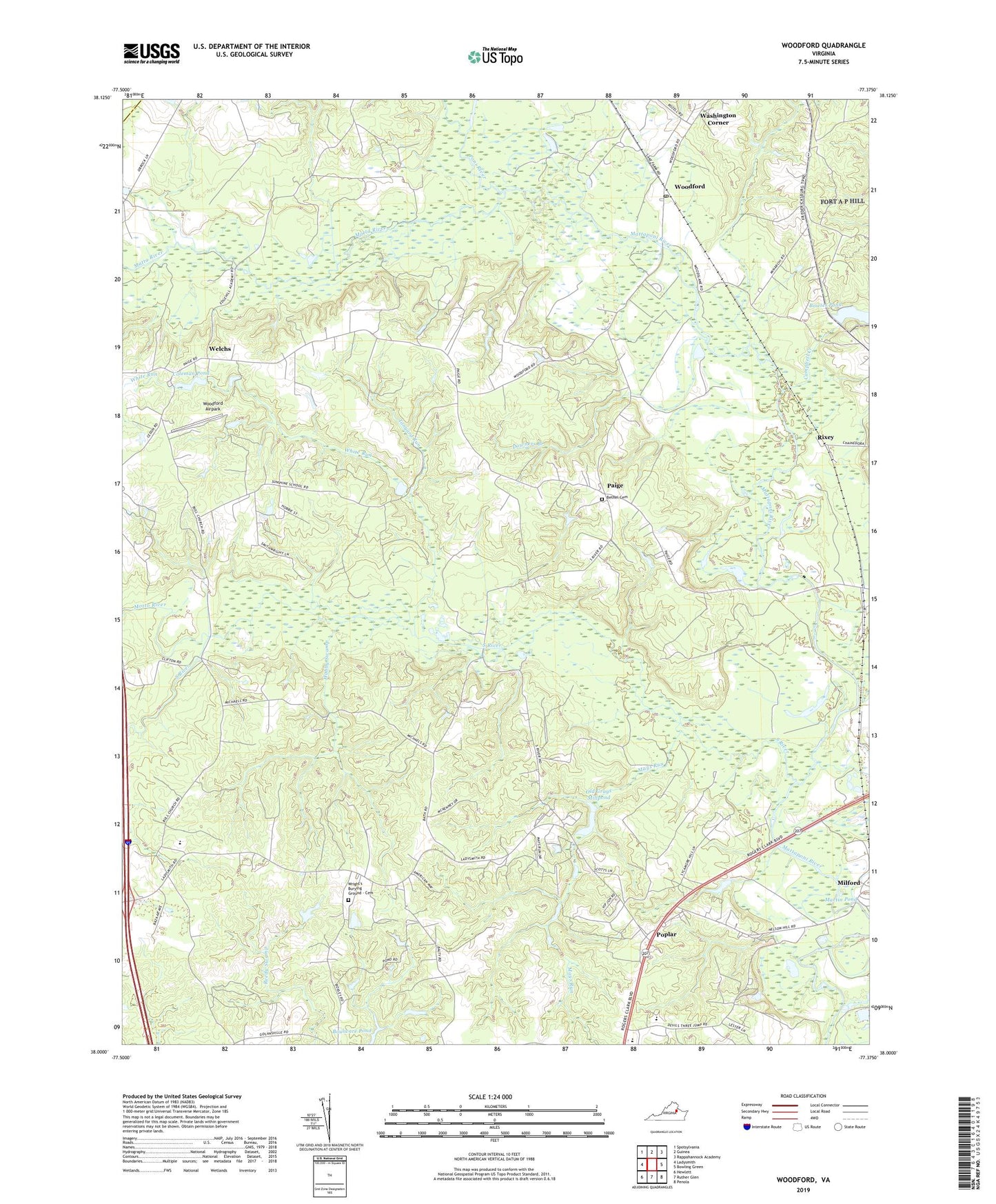
2022 topographic map quadrangle Woodford in the state of Virginia. Scale: 1:24000. Based on the newly updated USGS 7.5' US Topo map series, this map is in the following counties: Caroline, Spotsylvania. The map contains contour data, water features, and other items you are used to seeing on USGS maps, but also has updated roads and other features. This is the next generation of topographic maps. Printed on high-quality waterproof paper with UV fade-resistant inks.
Quads adjacent to this one:
West: Ladysmith
Northwest: Spotsylvania
North: Guinea
Northeast: Rappahannock Academy
East: Bowling Green
Southeast: Penola
South: Ruther Glen
Southwest: Hewlett
This map covers the same area as the classic USGS quad with code o38077a4.
Contains the following named places: Bethel Cemetery, Bethel Church, Bowies Dam, Bowies Pond, Bowling Green Park, Burkes Shop, Campbell Creek, Caroline High School, Caroline Middle School, Coleman Pond, Coleman Pond Dam, Colemans Garage Dam, Collins Crossing, Downers Branch, Hobby Swamp, Ladysmith Primary School, Lebanon Tabernacle, Madison Elementary School, Martin Pond, Matta River, Mays Run, Meadow Creek, Motto River, Old Grays Dam, Old Grays Millpond, Paige, Poni River, Poplar, Rixey, Saint John School, Saint Johns Church, Saint Marys Church, South River, Sunshine School, Tanyard Run, Third Mount Zion Church, Washington Corner, Welchs, White Run, Woodford, Woodford Airpark, Woodford Post Office, Woodford School, Wright Church, Wright's Burying Ground - Cemetery, Wrights Corner, ZIP Code: 22580