MyTopo
Ladysmith Virginia US Topo Map
Couldn't load pickup availability
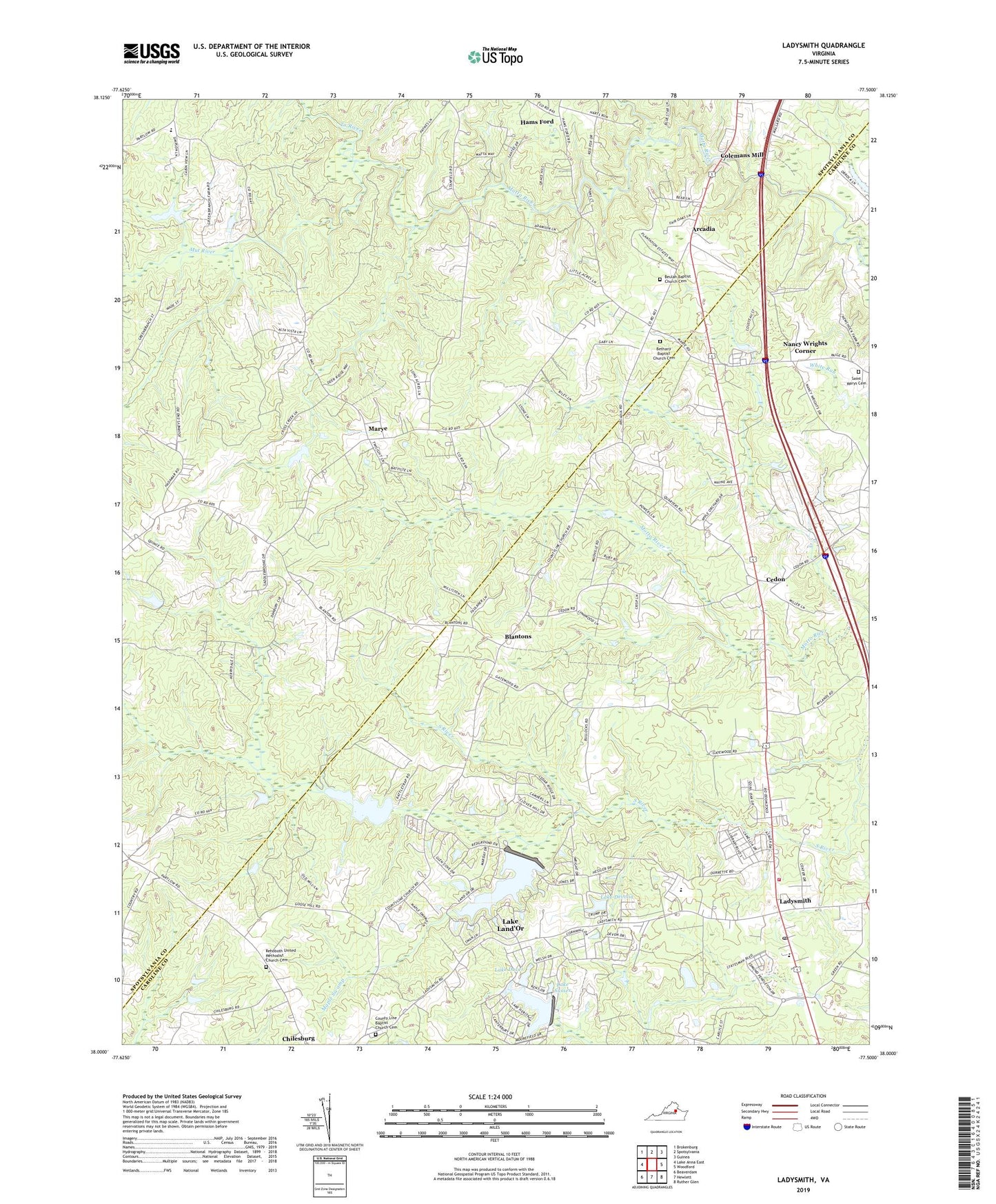
2022 topographic map quadrangle Ladysmith in the state of Virginia. Scale: 1:24000. Based on the newly updated USGS 7.5' US Topo map series, this map is in the following counties: Caroline, Spotsylvania. The map contains contour data, water features, and other items you are used to seeing on USGS maps, but also has updated roads and other features. This is the next generation of topographic maps. Printed on high-quality waterproof paper with UV fade-resistant inks.
Quads adjacent to this one:
West: Lake Anna East
Northwest: Brokenburg
North: Spotsylvania
Northeast: Guinea
East: Woodford
Southeast: Ruther Glen
South: Hewlett
Southwest: Beaverdam
This map covers the same area as the classic USGS quad with code o38077a5.
Contains the following named places: Ann Wrights Corner, Arcadia, Berkeley District, Berkeley Elementary School, Bethany Baptist Church Cemetery, Bethany Church, Beulah Baptist Church Cemetery, Beulah Church, Blades Corner, Blantons, Caroline County Fire and Rescue / Ladysmith Volunteer Fire Department Company 2, Caroline County Fire and Rescue / Ladysmith Volunteer Rescue Squad Rescue 2, Cedon, Colemans Mill, County Line Baptist Church Cemetery, County Line Church, Davis Corner, Ebenezer Church, Hams Ford, Ladysmith, Ladysmith Baptist Academy, Ladysmith Elementary School, Ladysmith Post Office, Ladysmith Village, Ladysmith Volunteer Rescue Squad R2, Lake Devolia, Lake Devolia Dam, Lake Dover, Lake Dover Dam, Lake Heritage, Lake Heritage Dam, Lake Landor, Lake Land'Or Census Designated Place, Lake Landor Dam, Lake Sussex, Madison District, Maple Swamp, Marye, Mat River, Nancy Wrights Corner, Rehoboth Church, Rehoboth United Methodist Church Cemetery, Ryland Corner, Saint Marys Cemetery, Smith Church, Smith High School, Ta River, Temples Milldam, Temples Millpond, Terrell Brothers Dam, Wallers Corner, Wrights Chapel